1
Westbourne Place
Terrace of 14 houses. c1852. By Pope, Bindon and Clarke. Limestone ashlar, brick party wall stacks, slate and concrete tile mansard roofs. Double-depth plan. Neoclassical style. Listed Grade II
Image: © Alan Murray-Rust
Taken: 24 Jun 2017
0.01 miles
2
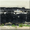
Bench mark, 92 Queen's Road, Clifton
See http://www.geograph.org.uk/photo/5444593 for location.
Image: © Alan Murray-Rust
Taken: 25 Jun 2017
0.02 miles
3
92 & 90 Queen's Road, Clifton
A pair of Victorian houses of less distinction than the majority in the immediate area. There is a bench mark http://www.geograph.org.uk/photo/5444590 on the house, below the 'Clifton' sign board.
Image: © Alan Murray-Rust
Taken: 25 Jun 2017
0.02 miles
4
Ordnance Survey Cut Mark
This OS cut mark can be found on No92 Queens Road. It marks a point 60.506m above mean sea level.
Image: © Adrian Dust
Taken: 2 Jan 2020
0.02 miles
5
Bristol : Queen's Court
Looking up towards the block of flats on Queen's Road.
Image: © Lewis Clarke
Taken: 19 Jul 2015
0.03 miles
6
Caffe Clifton
A canopy on St Paul's Road evoking an earlier time.
Image: © Neil Owen
Taken: 1 Jul 2021
0.03 miles
7
46 & 438 St Paul's Road, Clifton
A pair of neo-classical attached houses, c.1850. Listed Grade II.
Image: © Alan Murray-Rust
Taken: 24 Jun 2017
0.04 miles
8
Houses on St Paul's Road, Victoria Park
This "Pair of attached houses. c1850" are listed https://www.historicengland.org.uk/listing/the-list/list-entry/1366063 .
Image: © Derek Harper
Taken: 27 Oct 2017
0.04 miles
9
St Paul's Road, Bristol
Seen from the junction with Whiteladies Road. The mid-C19 St Paul's church is described at http://list.english-heritage.org.uk/resultsingle.aspx?uid=1207682&searchtype=mapsearch . The terrace this side of it is of the same era http://list.english-heritage.org.uk/resultsingle.aspx?uid=1207635&searchtype=mapsearch , as are the houses beyond http://list.english-heritage.org.uk/resultsingle.aspx?uid=1202556&searchtype=mapsearch http://list.english-heritage.org.uk/resultsingle.aspx?uid=1366063&searchtype=mapsearch http://list.english-heritage.org.uk/resultsingle.aspx?uid=1366065&searchtype=mapsearch and (the stepped Leicester Terrace) http://list.english-heritage.org.uk/resultsingle.aspx?uid=1202557&searchtype=mapsearch .
Image: © Derek Harper
Taken: 8 Sep 2013
0.04 miles
10
Tavistock Place, St Paul's Road
Tavistock Place refers to the terrace of houses on this section of St Paul's Road, but appears to be no longer in use as a postal address.
Image: © Alan Murray-Rust
Taken: 25 Jun 2017
0.04 miles


