1
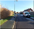
Branwhite Close, Bristol
Branwhite Close is a 90 metre long cul-de-sac on the east side of Bonnington Walk.
Overnight hoar frost remains on surfaces not yet reached by the rays of sun.
Image: © Jaggery
Taken: 29 Dec 2013
0.03 miles
2
Highmore Gardens
These red brick terraced social housing are part of the stock of housing in North Bristol that was once council housing.
Image: © Nigel Mykura
Taken: 23 Feb 2013
0.06 miles
3
Gainsborough Square
This square is interesting from a Geograph point of view as it covers the corners of four separate grid squares. This is the northwest corner of the square. the square is surrounded with blocks of apartments with shops on the lowest level such as this McColls newsagent, off-licence and convenience store.
Image: © Nigel Mykura
Taken: 23 Feb 2013
0.07 miles
4
Derelict former Gainsborough pub, Lockleaze, Bristol
Located on the north side of Gainsborough Square, the derelict building on the right used to be the Gainsborough pub, which closed down in March 2010. Now (late December 2013) boarded up and bricked up, with graffiti on the walls.
Image: © Jaggery
Taken: 29 Dec 2013
0.07 miles
5
McColl's Lockleaze, Bristol
Convenience store in the NW corner of Gainsborough Square, on the corner of Bonnington Walk.
Image: © Jaggery
Taken: 29 Dec 2013
0.07 miles
6
Gainsborough Square, Lockleaze
With re-paving work going on. Gridlines meet within the square, parts of which therefore occupy four squares.
Image: © Derek Harper
Taken: 29 Sep 2014
0.08 miles
7
Flat Rooves in Romney Avenue
Image: © don cload
Taken: 3 Sep 2018
0.08 miles
8
Virgin Media van in Stothard Road, Bristol
Viewed from the Bonnington Walk end.
Overnight hoar frost remains on surfaces not yet reached by the rays of sun.
Image: © Jaggery
Taken: 29 Dec 2013
0.08 miles
9
Electricity substation on the north side of Gainsborough Square, Lockleaze, Bristol
The identifier on the substation is 2586 GAINSBOROUGH SQUARE S/S.
Image: © Jaggery
Taken: 29 Dec 2013
0.08 miles
10
Habinteg Housing Association flats, Gainsborough Square, Lockleaze, Bristol
Located in the NE corner of the square. The dwellings are specifically designed for wheelchair users and have an emergency alarm system. Habinteg's slogan is "Accessible homes independent lives"
Image: © Jaggery
Taken: 29 Dec 2013
0.09 miles


