IMAGES TAKEN NEAR TO
Springfield Grove, BRISTOL, BS6 7XQ
Introduction
This page details the photographs taken nearby to Springfield Grove, BS6 7XQ by members of the Geograph project.
The Geograph project started in 2005 with the aim of publishing, organising and preserving representative images for every square kilometre of Great Britain, Ireland and the Isle of Man.

There are currently over 7.5m images from over14,400 individuals and you can help contribute to the project by visiting https://www.geograph.org.uk
Image Map
Images are licensed for reuse under creativecommons.org/licenses/by-sa/2.0
Notes
- Clicking on the map will re-center to the selected point.
- The higher the marker number, the further away the image location is from the centre of the postcode.
Image Listing (66 Images Found)
Images are licensed for reuse under creativecommons.org/licenses/by-sa/2.0
Image
Details
Distance
1
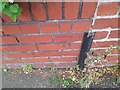
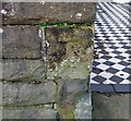
Ordnance Survey Cut Mark
This OS cut mark can be found on the wall NE side of Springfield Grove. It marks a point 75.220m above mean sea level.
Image: © Adrian Dust
Taken: 1 Jul 2022
0.01 miles
3
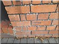
Ordnance Survey Cut Mark
This OS cut mark can be found on the wall of No105 Kellaway Avenue. It marks a point 68.345m above mean sea level.
Image: © Adrian Dust
Taken: 1 Jul 2022
0.08 miles
5
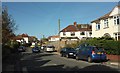
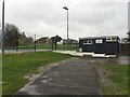
Bishop Road, Westbury Park
Approaching the traffic lights at the crossroads with Kellaway Avenue.
Image: © Derek Harper
Taken: 25 Oct 2017
0.09 miles
6

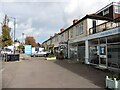
Shops on Kellaway Avenue, Bristol
The parade of shops includes a pilates studio, a financial management office, a Chinese medicine centre, an off-licence and a chemist.
Image: © Derek Harper
Taken: 2 May 2016
0.09 miles
8
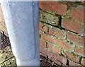
Ordnance Survey Cut Mark
This OS cut mark can be found on the wall of No15 Park Grove. It marks a point 75.432m above mean sea level.
Image: © Adrian Dust
Taken: 17 Jan 2020
0.10 miles
9
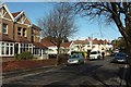
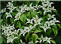
Park Grove, Westbury Park
Approaching the crossroads with Springfield Grove.
Image: © Derek Harper
Taken: 25 Oct 2017
0.10 miles
10
Ordnance Survey Cut Mark
This OS cut mark can be found on the wall junction of Nos 127 & 129 Howard Road. It marks a point 74.899m above mean sea level.
Image: © Adrian Dust
Taken: 17 Jan 2020
0.11 miles