IMAGES TAKEN NEAR TO
Cotham Road, BRISTOL, BS6 6DW

Introduction

This page details the photographs taken nearby to Cotham Road, BS6 6DW by members of the Geograph project.

The Geograph project started in 2005 with the aim of publishing, organising and preserving representative images for every square kilometre of Great Britain, Ireland and the Isle of Man.

There are currently over 7.5m images from over14,400 individuals and you can help contribute to the project by visiting https://www.geograph.org.uk

Image Map


Images are licensed for reuse under creativecommons.org/licenses/by-sa/2.0
Notes
  • Clicking on the map will re-center to the selected point.
  • The higher the marker number, the further away the image location is from the centre of the postcode.

Image Listing (324 Images Found)

Images are licensed for reuse under creativecommons.org/licenses/by-sa/2.0
  • ...
Image
Details
Distance
1
Pitch Lane meets Cotham Road
A reverse view of Image and Image
Image: © Derek Harper Taken: 14 Dec 2017
0.02 miles
2
Victorian postbox, Cotham Road
Also shown in Image, and subject to a new set of graffiti. The letterbox is numbered BS6 297.
Image: © Derek Harper Taken: 14 Dec 2017
0.02 miles
3
Victorian box on Cotham Road
A surviving Victorian letterbox set into a wall along Cotham Road. Unusually for Bristol, it was made by B. P. Walker's Eagle Foundry of Birmingham.
Image: © Neil Owen Taken: 25 Sep 2023
0.02 miles
4
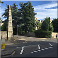
Cotham, obelisks
On Cotham Brow, at the junction with Cotham Park; listed by English Heritage: http://www.imagesofengland.org.uk/Details/Default.aspx?id=379428&mode=adv
Image: © Mike Faherty Taken: 30 Mar 2014
0.02 miles
5
Houses on Cotham Road
This trio of houses with fancy gables are divided into flats. "An unusual picturesque silhouette to a standard attached house plan" https://www.historicengland.org.uk/listing/the-list/list-entry/1207757 .
Image: © Derek Harper Taken: 4 Apr 2018
0.02 miles
6
Bristol : Cotham Road
A road at the junction with Cotham Road South.
Image: © Lewis Clarke Taken: 24 Mar 2015
0.02 miles
7
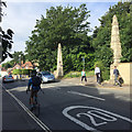
Pair of obelisks at the turn in to Cotham Park, Cotham, Bristol
The obelisks marked the entrance to Cotham Park, "developed by Francis and Richard Fry on the land of Cotham Lodge [after it was] demolished, 1846." They are listed Grade II: https://historicengland.org.uk/listing/the-list/list-entry/1207692 Eight-thirty on a sunny morning – everyone's going to work. I was waiting for a bus to take me to the summer meet and AGM of Geograph Project Limited in the city centre. A display in Bristol Museum and Art Gallery explains: "A pair of obelisks made of White Lias [limestone] with the upper surface of Cotham Marble used as naturally 'vermiculated' blocking. Many weathered blocks have had to be replaced with carved vermiculation." A closer look at Cotham Marble is Image "White and Blue Lias Limestone The muddy limestones from the top of the Triassic beds and bottom of the Jurassic are generally only used locally, on the outcrop – Horfield, Knowle, Cotham, Keynsham. Many of the beds tend not to weather well."
Image: © Robin Stott Taken: 26 Jun 2017
0.03 miles
8
The Cotham Park turn, Cotham Road, Bristol
The obelisk is one of a pair, listed grade II. https://historicengland.org.uk/listing/the-list/list-entry/1207692 Compare Mike Faherty's Image – in three years the northern obelisk of the pair has become obscured by a sycamore seedling. A display in Bristol Museum and Art Gallery explains: "A pair of obelisks made of White Lias [limestone] with the upper surface of Cotham Marble used as naturally 'vermiculated' blocking. Many weathered blocks have had to be replaced with carved vermiculation." A closer look at Cotham Marble is Image The obelisks marked the entrance to Cotham Park, "developed by Francis and Richard Fry on the land of Cotham Lodge [after it was] demolished, 1846." "White and Blue Lias Limestone The muddy limestones from the top of the Triassic beds and bottom of the Jurassic are generally only used locally, on the outcrop – Horfield, Knowle, Cotham, Keynsham. Many of the beds tend not to weather well."
Image: © Robin Stott Taken: 26 Jun 2017
0.03 miles
9
A lane to garages off St Matthew's Road
Just by the entrance is a boundary stone - see https://www.geograph.org.uk/photo/6134408 for a closer look.
Image: © Neil Owen Taken: 25 Apr 2019
0.03 miles
10
Oriel House, Bristol
On Cotham Road. The Tudor Revival house, also visible in Image] and Image], has "3 irregular sections, each stepping slightly forward of that to the left", the central gable has "round Tudor finials with diagonal patterning" https://historicengland.org.uk/listing/the-list/list-entry/1207750 , which has more detail.
Image: © Derek Harper Taken: 2 Mar 2020
0.03 miles
  • ...