IMAGES TAKEN NEAR TO
Glebe Road, BRISTOL, BS5 8JJ
Introduction
This page details the photographs taken nearby to Glebe Road, BS5 8JJ by members of the Geograph project.
The Geograph project started in 2005 with the aim of publishing, organising and preserving representative images for every square kilometre of Great Britain, Ireland and the Isle of Man.

There are currently over 7.5m images from over14,400 individuals and you can help contribute to the project by visiting https://www.geograph.org.uk
Image Map
Images are licensed for reuse under creativecommons.org/licenses/by-sa/2.0
Notes
- Clicking on the map will re-center to the selected point.
- The higher the marker number, the further away the image location is from the centre of the postcode.
Image Listing (60 Images Found)
Images are licensed for reuse under creativecommons.org/licenses/by-sa/2.0
Image
Details
Distance
1
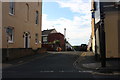
Summerhill Road
Nearly in Redfield. The hill slopes down towards the city centre of Bristol.
Image: © Bill Boaden
Taken: 28 Sep 2017
0.08 miles
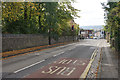
3
Strawberry Lane
An old lane that predates much of the nineteenth century expansion of the area, it goes down towards the old quarries and clay works of Crews Hole.
Image: © Neil Owen
Taken: 2 Feb 2022
0.09 miles
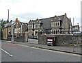
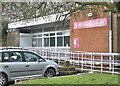
4
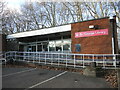
St George library
A modern brick library stands just inside the grounds of St George's Park. It replaces the older Victoria Free library that was here around the turn of the 1900s. An odd stone stump is by the ramp - see Image
Image: © Neil Owen
Taken: 2 Feb 2022
0.09 miles
5
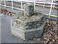
A stump of a cross in the library
This stone relic is right outside the library, but what is it? A short distance down the road is the site of the old Don John's Cross, which is an old preaching cross of unknown age that was placed on the main Bristol road beside a water fountain and trough. The area is now built over but this is believed to be the remains of that cross.
Image: © Neil Owen
Taken: 2 Feb 2022
0.09 miles
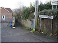
7
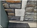
Ordnance Survey Cut Mark
This OS cut mark can be found on No33 The Avenue. It marks a point 61.365m above mean sea level.
Image: © Adrian Dust
Taken: 1 Aug 2022
0.09 miles
8

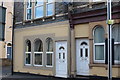
Fountain Cafe, St George
This looks like a nice traditional greasy spoon cafe, on Church Road (the A420). Alas, no time to patronise it. On its left is Beaconsfield Road.
Image: © Derek Harper
Taken: 31 Mar 2012
0.09 miles
9
Parking for books
St George, Bristol
Image: © Anthony O'Neil
Taken: 15 Feb 2021
0.10 miles