IMAGES TAKEN NEAR TO
Beaufort Road, BRISTOL, BS5 8FL

Introduction

This page details the photographs taken nearby to Beaufort Road, BS5 8FL by members of the Geograph project.

The Geograph project started in 2005 with the aim of publishing, organising and preserving representative images for every square kilometre of Great Britain, Ireland and the Isle of Man.

There are currently over 7.5m images from over14,400 individuals and you can help contribute to the project by visiting https://www.geograph.org.uk

Image Map


Images are licensed for reuse under creativecommons.org/licenses/by-sa/2.0
Notes
  • Clicking on the map will re-center to the selected point.
  • The higher the marker number, the further away the image location is from the centre of the postcode.

Image Listing (74 Images Found)

Images are licensed for reuse under creativecommons.org/licenses/by-sa/2.0
  • ...
Image
Details
Distance
1
The old church in Pilemarsh
The building is not actually that old - a twentieth century construction - and was a Roman Catholic church before conversion to residential. The dormer windows are part of the changes.
Image: © Neil Owen Taken: 2 Feb 2022
0.02 miles
2
Ordnance Survey Cut Mark
This OS cut mark can be found on the north face of St Patrick's RC Church. It marks a point 38.786m above mean sea level.
Image: © Adrian Dust Taken: 19 Jul 2021
0.02 miles
3
St Patrick's RC Church, Pile Marsh
There is an OS benchmark Image on the far corner of the church
Image: © Roger Templeman Taken: 2 May 2017
0.02 miles
4
Benchmark on St Patrick's Church, Pile Marsh
Ordnance Survey cut mark benchmark described on the Bench Mark Database at http://www.bench-marks.org.uk/bm80621
Image: © Roger Templeman Taken: 2 May 2017
0.02 miles
5
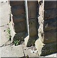
Benchmark on former Hauliers Arms pub
Ordnance Survey cut mark benchmark described on the Bench Mark Database at http://www.bench-marks.org.uk/bm80622
Image: © Roger Templeman Taken: 2 May 2017
0.06 miles
6
Former public house, Hauliers Arms, Pilemarsh
There is an OS benchmark Image on a stone at the base of the column at the near corner of the building
Image: © Roger Templeman Taken: 2 May 2017
0.06 miles
7
Ordnance Survey Cut Mark
This very worn OS cut mark can be found on The Hauliers Arms PH. It marks a point 35.409m above mean sea level.
Image: © Adrian Dust Taken: 19 Jul 2021
0.06 miles
8
The old Hauliers Arms
A former pub, now residence, in Pilemarsh. It was closed in 2011; note the doors have been bricked up now.
Image: © Neil Owen Taken: 2 Feb 2022
0.06 miles
9
George and Dragon Lane
A small lane leading north from Pilemarsh: in the past the land went past Clifton Street, which has since been demolished. It may come as no surprise that at the end of the lane is the George and Dragon pub.
Image: © Neil Owen Taken: 2 Feb 2022
0.07 miles
10
St Patrick in colour
The new church in Pile Marsh has a tower feature with some stained glass effects.
Image: © Neil Owen Taken: 2 Feb 2022
0.07 miles
  • ...