1
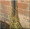
Ordnance Survey Cut Mark
This OS cut mark can be found on No112 St Marks Road. It marks a point 14.246m above mean sea level.
Image: © Adrian Dust
Taken: 19 Jul 2021
0.15 miles
2
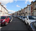
High Street, Easton
Not a traditional high street, but a typically tightly packed residential street.
Image: © Bill Boaden
Taken: 14 Apr 2017
0.15 miles
3
Belle Vue News
A typical corner shop on the corner of Tudor Road and Belle Vue Road.
Image: © Bill Boaden
Taken: 14 Apr 2017
0.16 miles
4
Argyle Street, Easton
Looking across the A432 Fishponds Road. The side street crosses to the B4058.
Image: © Derek Harper
Taken: 7 Sep 2013
0.16 miles
5
Junction on Stapleton Road
The traffic is waiting at the lights to turn out of the B4058, Stapleton Road. The A432, which is Stapleton Road to the left past the row of shops, continues to the right as Fishponds Road. The brick building on the right is Ashbourne House, offices.
Image: © Derek Harper
Taken: 7 Sep 2013
0.17 miles
6
Nowhere left to park in Clare Road, Easton, Bristol
Viewed from the corner of Stapleton Road at 2:40pm on Thursday September 13th 2018.
A June 2014 Google Earth Street View shows a similar scene dominated by parked cars.
Image: © Jaggery
Taken: 13 Sep 2018
0.18 miles
7
The Church of God of Prophecy, Bristol
Formerly Tudor Road Methodist Church.
Image: © Bill Boaden
Taken: 14 Apr 2017
0.18 miles
8
Easton Jamia Masjid mosque
The Easton Mosque as it is commonly known is situated in an old Church hall near the shops in St Marks Road. It is one of the larger Mosques in Bristol holding up to 600 people.
Image: © Eirian Evans
Taken: 31 Aug 2018
0.18 miles
9
Ordnance Survey Cut Mark
This OS cut mark can be found on No417 Stapleton Road. It marks a point 12.661m above mean sea level.
Image: © Adrian Dust
Taken: 19 Jul 2021
0.18 miles
10
On-street parking, Berwick Road, Easton, Bristol
Nowhere in view to park at 2:37pm on Thursday September 13th 2018.
Image: © Jaggery
Taken: 13 Sep 2018
0.19 miles


