1
The Perrings, Nailsea
Road on the south side of Queens Road. The left turn ahead is into Cheddar Close.
Image: © Jaggery
Taken: 8 Jun 2016
0.02 miles
2
Leafy suburban junction in Nailsea
The junction of Queens Road and leafy Farlers End.
There is no apostrophe on the name signs for both Queens Road and Farlers End.
Image: © Jaggery
Taken: 8 Jun 2016
0.09 miles
3
Queens Road from Station Road, Nailsea
The 30mph speed limit on Station Road increases to 40mph on Queens Road.
Image: © Jaggery
Taken: 8 Jun 2016
0.10 miles
4
Queen Elizabeth II pillarbox, Queens Road, Nailsea
Alongside a bus stop for First buses towards the town centre.
Image: © Jaggery
Taken: 8 Jun 2016
0.11 miles
5
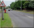
Warning sign - slippery road, Queens Road, Nailsea
Facing the Station Road junction. In the UK, red-edged triangular signs indicate a warning.
Image: © Jaggery
Taken: 8 Jun 2016
0.11 miles
6
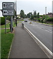
Directions sign facing Bucklands Batch, Nailsea
Ahead for Clevedon and Bristol or turn left for Nailsea town centre.
Behind this sign, a street names sign marks the point where Bucklands Batch becomes Station Road.
Image: © Jaggery
Taken: 8 Jun 2016
0.12 miles
7
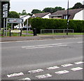
From Bucklands Batch to Station Road, Nailsea
Viewed from the Trendlewood Way junction http://www.geograph.org.uk/photo/5043779 where Bucklands Batch on the left becomes Station Road.
Image: © Jaggery
Taken: 8 Jun 2016
0.12 miles
8
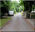
Bucklands Lane, Nailsea
Cul-de-sac on the west side of Bucklands Batch.
Image: © Jaggery
Taken: 8 Jun 2016
0.12 miles
9
Bucklands End, Nailsea
Private cul-de-sac on the west side of Station Road.
Image: © Jaggery
Taken: 8 Jun 2016
0.12 miles
10
Distances from southern Nailsea
The signpost is alongside Station Road at the Trendlewood Way junction.
Left for Backwell (1½ miles) and Bristol (8) or right for (central) Nailsea (¾) and Clevedon (5).
Image: © Jaggery
Taken: 13 Jul 2012
0.12 miles


