1
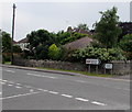
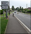
Western end of Trendlewood Way, Nailsea
Viewed across Bucklands Batch.
Image: © Jaggery
Taken: 8 Jun 2016
0.07 miles
2
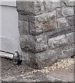
Ordnance Survey Cut Mark
This OS cut mark can be found on the tower SE side of Trendlewood Way. It marks a point 25.393m above mean sea level.
Image: © Adrian Dust
Taken: 30 Jul 2022
0.08 miles
3
Station Road directions signs, Nailsea
Facing the eastern end of Queens Road. http://www.geograph.org.uk/photo/5043830
Left (north) on Station Road for Clevedon and Bristol or right for Nailsea & Backwell railway station.
Image: © Jaggery
Taken: 8 Jun 2016
0.08 miles
4
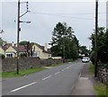
Wires over Station Road, Nailsea
Over Station Road north of the Queens Road junction. http://www.geograph.org.uk/photo/5043830
Image: © Jaggery
Taken: 8 Jun 2016
0.08 miles
5
Old Direction Sign - Signpost by Station Road, Nailsea
Pyramid finial - 3 arms; Somerset SCC pyramid (Sheldon) by the UC road, in parish of Nailsea (North Somerset District), Station Road junction with Bucklands Batch and Trendlewood Way, on cut verge by telegraph pole.
To be surveyed
Milestone Society National ID: SO_ST4769
Image: © Alan Rosevear
Taken: 24 Sep 2012
0.09 miles
6
Distances from southern Nailsea
The signpost is alongside Station Road at the Trendlewood Way junction.
Left for Backwell (1½ miles) and Bristol (8) or right for (central) Nailsea (¾) and Clevedon (5).
Image: © Jaggery
Taken: 13 Jul 2012
0.10 miles
7
From Bucklands Batch to Station Road, Nailsea
Viewed from the Trendlewood Way junction http://www.geograph.org.uk/photo/5043779 where Bucklands Batch on the left becomes Station Road.
Image: © Jaggery
Taken: 8 Jun 2016
0.10 miles
8
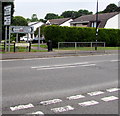
Directions sign facing Bucklands Batch, Nailsea
Ahead for Clevedon and Bristol or turn left for Nailsea town centre.
Behind this sign, a street names sign marks the point where Bucklands Batch becomes Station Road.
Image: © Jaggery
Taken: 8 Jun 2016
0.10 miles
9
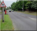
Warning sign - slippery road, Queens Road, Nailsea
Facing the Station Road junction. In the UK, red-edged triangular signs indicate a warning.
Image: © Jaggery
Taken: 8 Jun 2016
0.11 miles
10
Queen Elizabeth II pillarbox, Queens Road, Nailsea
Alongside a bus stop for First buses towards the town centre.
Image: © Jaggery
Taken: 8 Jun 2016
0.11 miles


