1
Electricity sub-station
Image: © Dr Duncan Pepper
Taken: 13 Jan 2012
0.04 miles
2
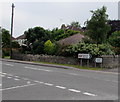
Leafy suburban junction in Nailsea
The junction of Queens Road and leafy Farlers End.
There is no apostrophe on the name signs for both Queens Road and Farlers End.
Image: © Jaggery
Taken: 8 Jun 2016
0.08 miles
3
The Perrings, Nailsea
Road on the south side of Queens Road. The left turn ahead is into Cheddar Close.
Image: © Jaggery
Taken: 8 Jun 2016
0.10 miles
4
Queens Road from Station Road, Nailsea
The 30mph speed limit on Station Road increases to 40mph on Queens Road.
Image: © Jaggery
Taken: 8 Jun 2016
0.10 miles
5
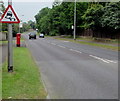
Warning sign - slippery road, Queens Road, Nailsea
Facing the Station Road junction. In the UK, red-edged triangular signs indicate a warning.
Image: © Jaggery
Taken: 8 Jun 2016
0.11 miles
6
Queen Elizabeth II pillarbox, Queens Road, Nailsea
Alongside a bus stop for First buses towards the town centre.
Image: © Jaggery
Taken: 8 Jun 2016
0.11 miles
7
Wedmore Road, Nailsea
Viewed across Queens Road.
Image: © Jaggery
Taken: 8 Jun 2016
0.12 miles
8
East along Little Meadow End, Nailsea
Little Meadow End extends for 110 metres from Ash Hayes Road behind the camera. Four concrete posts across Little Meadow End in the distance block access to Wedmore Road and Rickford Road for motor vehicles.
Image: © Jaggery
Taken: 8 Jun 2016
0.12 miles
9
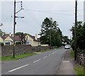
Wires over Station Road, Nailsea
Over Station Road north of the Queens Road junction. http://www.geograph.org.uk/photo/5043830
Image: © Jaggery
Taken: 8 Jun 2016
0.12 miles
10
Station Road directions signs, Nailsea
Facing the eastern end of Queens Road. http://www.geograph.org.uk/photo/5043830
Left (north) on Station Road for Clevedon and Bristol or right for Nailsea & Backwell railway station.
Image: © Jaggery
Taken: 8 Jun 2016
0.13 miles


