IMAGES TAKEN NEAR TO
Russett Grove, BRISTOL, BS48 4GB
Introduction
This page details the photographs taken nearby to Russett Grove, BS48 4GB by members of the Geograph project.
The Geograph project started in 2005 with the aim of publishing, organising and preserving representative images for every square kilometre of Great Britain, Ireland and the Isle of Man.

There are currently over 7.5m images from over14,400 individuals and you can help contribute to the project by visiting https://www.geograph.org.uk
Image Map (Loading...)


Getting Data...Please wait
Leaflet Map data © OpenStreetMap
Images are licensed for reuse under creativecommons.org/licenses/by-sa/2.0
Notes
- Clicking on the map will re-center to the selected point.
- The higher the marker number, the further away the image location is from the centre of the postcode.
Image Listing (9 Images Found)
Images are licensed for reuse under creativecommons.org/licenses/by-sa/2.0
Image
Details
Distance
2
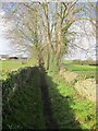
Footpath to West End and Nursebatch Farm
Image: © Dr Duncan Pepper
Taken: 27 Feb 2014
0.20 miles
3
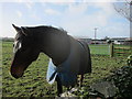
Equine grazing land at Nursebatch Farm
Image: © Dr Duncan Pepper
Taken: 27 Feb 2014
0.20 miles
4
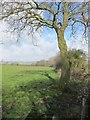
Field edge boundary near Nursebatch Farm
Tickenham just visible in the distance.
Image: © Dr Duncan Pepper
Taken: 27 Feb 2014
0.20 miles
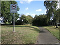
5
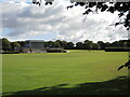
Grove Park
Recreation and education sports grounds.
Image: © Neil Owen
Taken: 29 Sep 2021
0.22 miles
6
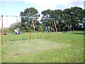
Play park off Hannah More Road
The trees shield the users from the large industrial estate beyond.
Image: © Neil Owen
Taken: 29 Sep 2021
0.23 miles
7
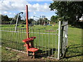
Metal stile to the play park
An unusual and particularly modern stile to aid access to the playground.
Image: © Neil Owen
Taken: 29 Sep 2021
0.23 miles
8
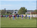
Nailsea United v Minehead
In a Somerset Premier League Match at the Grove. Nailsea won the game 3-0.
Image: © Roger Cornfoot
Taken: 6 May 2013
0.25 miles
9
Path to Hannah More Road
Running at the edge of the post-war housing and industrial estates, the path is not for all.
Image: © Neil Owen
Taken: 29 Sep 2021
0.25 miles