IMAGES TAKEN NEAR TO
Oaksey Grove, BRISTOL, BS48 2TP
Introduction
This page details the photographs taken nearby to Oaksey Grove, BS48 2TP by members of the Geograph project.
The Geograph project started in 2005 with the aim of publishing, organising and preserving representative images for every square kilometre of Great Britain, Ireland and the Isle of Man.

There are currently over 7.5m images from over14,400 individuals and you can help contribute to the project by visiting https://www.geograph.org.uk
Image Map
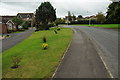
Images are licensed for reuse under creativecommons.org/licenses/by-sa/2.0
Notes
- Clicking on the map will re-center to the selected point.
- The higher the marker number, the further away the image location is from the centre of the postcode.
Image Listing (14 Images Found)
Images are licensed for reuse under creativecommons.org/licenses/by-sa/2.0
Image
Details
Distance
2
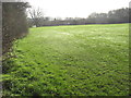
School playing fields, Nailsea
On the south side of Golden Valley Primary School.
Image: © Jaggery
Taken: 13 Jul 2012
0.14 miles
3
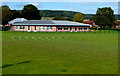
Goals in hibernation
Some woodwork left at the edge of the playing fields, waiting for the new season to kick off.
Image: © Neil Owen
Taken: 29 Sep 2021
0.15 miles
4
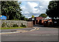
Entrance to Golden Valley Primary School, Nailsea
From the road named Nailsea Park.
Image: © Jaggery
Taken: 13 Jul 2012
0.16 miles
5
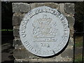
Fields In Trust
The plaque outside the entrance gates to Millennium Park. See Image for a wider look.
Image: © Neil Owen
Taken: 29 Sep 2021
0.18 miles
6
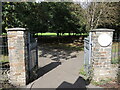
Entrance to Millennium Park
The gates to Nailsea's biggest park. The circular plaque (suffering from overexposure on a contrasty shot) is a Queen Elizabeth II Fields In Trust device, dated the Jubilee year of 2012. See Image for a clearer view.
Image: © Neil Owen
Taken: 29 Sep 2021
0.19 miles
7
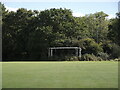
Must be a short footpath
Actually it is, as it leads from Trendlewood Way, through one of the green areas left by the new construction to the recreation ground on Station Road.
Image: © Steve Barnes
Taken: 23 Jul 2009
0.19 miles
8
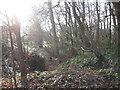
Woodland on the edge of a former sandstone quarry
The local red pennant sandstone was used for roofing.
Image: © Dr Duncan Pepper
Taken: 13 Jan 2012
0.20 miles
10
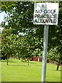
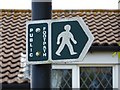
I guess there have been problems with golfers
Not a sign I have seen before, a lot more specific than 'No Ball Games' usually seen.
Image: © Steve Barnes
Taken: 23 Jul 2009
0.21 miles