IMAGES TAKEN NEAR TO
Dunkery Close, BRISTOL, BS48 2LB
Introduction
This page details the photographs taken nearby to Dunkery Close, BS48 2LB by members of the Geograph project.
The Geograph project started in 2005 with the aim of publishing, organising and preserving representative images for every square kilometre of Great Britain, Ireland and the Isle of Man.

There are currently over 7.5m images from over14,400 individuals and you can help contribute to the project by visiting https://www.geograph.org.uk
Image Map (Loading...)


Getting Data...Please wait
Leaflet Map data © OpenStreetMap
Images are licensed for reuse under creativecommons.org/licenses/by-sa/2.0
Notes
- Clicking on the map will re-center to the selected point.
- The higher the marker number, the further away the image location is from the centre of the postcode.
Image Listing (61 Images Found)
Images are licensed for reuse under creativecommons.org/licenses/by-sa/2.0
Image
Details
Distance
1
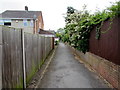
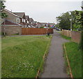
Footpath between fences, Nailsea
From the west side of Mizzymead Road, the path leads to Dunkery Close and Coombe Road.
Image: © Jaggery
Taken: 8 Jun 2016
0.02 miles
2
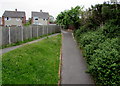
Path junction near Mizzymead Road, Nailsea
On the west side of Mizzymead Road, the path on the left joins a path ascending from a Mizzymead Road underpass.
Image: © Jaggery
Taken: 8 Jun 2016
0.04 miles
3
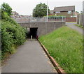
Underpass below Mizzymead Road, Nailsea
A footpath from Coombe Road descends towards the Mizzymead Road underpass.
Image: © Jaggery
Taken: 8 Jun 2016
0.05 miles
4
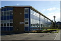
Hillcrest Road, Nailsea
On the west side of Mizzymead Road.
Image: © Jaggery
Taken: 8 Jun 2016
0.05 miles
5
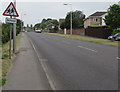
Warning sign - school, Mizzymead Road, Nailsea
On the approach to Nailsea School. http://www.geograph.org.uk/photo/5049147
Image: © Jaggery
Taken: 8 Jun 2016
0.05 miles
6
Ash Hayes Drive, Nailsea
A footpath on the far side of this http://www.geograph.org.uk/photo/5419790 underpass ascends towards Ash Hayes Drive.
Image: © Jaggery
Taken: 8 Jun 2016
0.10 miles
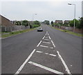
7
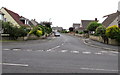
Mizzymead Road toward Nailsea town centre
Mizzymead Road is here between the two junctions with Hillcrest Road which
follows a roughly rectangular course beyond the left (west) side of the photo.
Image: © Jaggery
Taken: 8 Jun 2016
0.11 miles
8
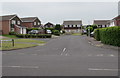
Porlock Gardens, Nailsea
Cul-de-sac viewed across Mizzymead Road.
Image: © Jaggery
Taken: 8 Jun 2016
0.11 miles
9
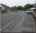
Mizzymead Road, Nailsea
From Queens Road along Mizzymead Road towards the town centre.
Image: © Jaggery
Taken: 8 Jun 2016
0.11 miles