
IMAGES TAKEN NEAR TO
Ripon Road, BRISTOL, BS4 4BT
Introduction
This page details the photographs taken nearby to Ripon Road, BS4 4BT by members of the Geograph project.
The Geograph project started in 2005 with the aim of publishing, organising and preserving representative images for every square kilometre of Great Britain, Ireland and the Isle of Man.

There are currently over 7.5m images from over14,400 individuals and you can help contribute to the project by visiting https://www.geograph.org.uk
Image Map
Images are licensed for reuse under creativecommons.org/licenses/by-sa/2.0
Notes
- Clicking on the map will re-center to the selected point.
- The higher the marker number, the further away the image location is from the centre of the postcode.
Image Listing (34 Images Found)
Images are licensed for reuse under creativecommons.org/licenses/by-sa/2.0
Image
Details
Distance
1
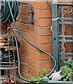
Ordnance Survey Cut Mark
This OS cut mark can be found on No47 Guildford Road. It marks a point 42.779m above mean sea level.
Image: © Adrian Dust
Taken: 22 Apr 2022
0.04 miles
2
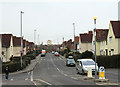
2010 : Guildford Road, St.Anne's Park, Bristol
Taken from the northern end of Birchwood Road.
The block of flats is on the other side of the River Avon in St. George.
Image: © Maurice Pullin
Taken: 26 Nov 2010
0.05 miles
3
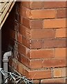
Ordnance Survey Cut Mark
This OS cut mark can be found on No65 St Davids Crescent. It marks a point 41.124m above mean sea level.
Image: © Adrian Dust
Taken: 22 Apr 2022
0.05 miles
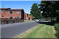
6
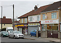
2010 : Row of shops in Birchwood Road, St. Annes's Park
Fish and chips this end, general store the other, but the fitness centre in the middle, is that double entendre or what?
Image: © Maurice Pullin
Taken: 26 Nov 2010
0.14 miles
7
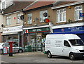
2010 : Post Office, Birchwood Road, St.Anne's Park
At the north end of Birchwood Road with a unisex hair salon on one side and an off licence with a video library on the other.
Bristol
Image: © Maurice Pullin
Taken: 26 Nov 2010
0.14 miles
8
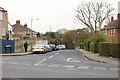
2010 : St. Anne's Park Road, Bristol
Seen from the southern end of Birchwood Road.
St. Anne's Park Road leads down to the Brislington Brook and St. Anne's Wood, a nature and leisure area created along the brook.
Image: © Maurice Pullin
Taken: 26 Nov 2010
0.15 miles
9
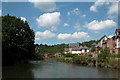
River Avon passing St Annes Park, Bristol
Image: © Martyn Pattison
Taken: 2 Aug 2005
0.16 miles
10
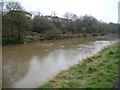
Riverside homes, north-west bank of the Avon
In Robertson Drive, St Anne's Park [the former site of paper mills].
Image: © Christine Johnstone
Taken: 23 Mar 2013
0.16 miles