1
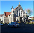
Redeemed Christian Church of God, Knowle, Bristol
Located on the corner of Wells Road and Oakmeade Park, this is the Power House Parish church of the Redeemed Christian Church of God, which dates its origins to 1952 in Lagos, Nigeria.
Knowle Methodist Church http://www.geograph.org.uk/photo/3225359 is in the background.
Image: © Jaggery
Taken: 11 Nov 2012
0.03 miles
2
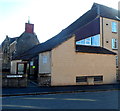
Shops at the eastern end of Redcatch Road, Knowle, Bristol
Nearest the camera is Happy House, Chinese cuisine takeaway. A previous use of the premises is preserved in an inscription in stone above the upper floor windows:
T L SAGE VICTORIA BAKERY.
Next door is Don Gay's Flower Arrangements.
Image: © Jaggery
Taken: 11 Nov 2012
0.03 miles
3
Sage's bakery
The date of this bakery is from around the turn of the 1900s, when the area grew slowly along the main Wells Road. Prior to that, there were a few limekilns locally and Bristol's horse racing circuit (1873-80) would also have drawn large numbers to Knowle. See
Image] for a wider view.
Image: © Neil Owen
Taken: 30 May 2019
0.03 miles
4
From one food provider to another
The old bakery at the top of Redcatch Road is now a Chinese take-away. See
Image] for a look at the original identifying stonework.
Image: © Neil Owen
Taken: 30 May 2019
0.03 miles
5
Methodist Church, Knowle, Bristol
Occupying the corner of Redcatch Road and Wells Road,
the church first opened for worship on December 6th 1904.
Image: © Jaggery
Taken: 11 Nov 2012
0.04 miles
6
Knowle Methodists' roofline
The church is a little over a century old and has seen the trees lining the road have a trim on many occasions.
Image: © Neil Owen
Taken: 19 May 2022
0.04 miles
7
Knowle Methodist Church
An early twentieth century addition to the area as it was growing rapidly.
Image: © Neil Owen
Taken: 19 May 2022
0.05 miles
8
Knowle, Bristol, Methodist Church
At the corner of Redcatch Road and Well Road
Image: © ChurchCrawler
Taken: 23 May 2004
0.05 miles
9
Bus stop on Wells Road
Near Knowle Methodist Church
Image: © Eirian Evans
Taken: 11 Apr 2019
0.05 miles
10
SW side of Oakmeade Park, Knowle, Bristol
Viewed across Redcatch Road.
Oakmeade Park is a short (c80m) residential street leading to Wells Road.
Image: © Jaggery
Taken: 11 Nov 2012
0.05 miles


