IMAGES TAKEN NEAR TO
Long Ashton, BRISTOL, BS41 9LX

Introduction

This page details the photographs taken nearby to BS41 9LX by members of the Geograph project.

The Geograph project started in 2005 with the aim of publishing, organising and preserving representative images for every square kilometre of Great Britain, Ireland and the Isle of Man.

There are currently over 7.5m images from over14,400 individuals and you can help contribute to the project by visiting https://www.geograph.org.uk

Image Map


Images are licensed for reuse under creativecommons.org/licenses/by-sa/2.0
Notes
  • Clicking on the map will re-center to the selected point.
  • The higher the marker number, the further away the image location is from the centre of the postcode.

Image Listing (42 Images Found)

Images are licensed for reuse under creativecommons.org/licenses/by-sa/2.0
  • ...
Image
Details
Distance
1
Bristol Pubs (14)
Ashton Road
Image: © Anthony O'Neil Taken: 21 Apr 2020
0.01 miles
2
The Ashton
Image: © Roger Cornfoot Taken: 24 Apr 2017
0.01 miles
3
Long Ashton, The Dovecote
Pub on Ashton Road; back bar, drinking and eating areas front and right, dining room left; patio. Cask ales on offer at my visit: Butcombe Bitter, Moor Northern Star. For some customer comments, see http://www.beerintheevening.com/pubs/s/24/24657/Dovecote/Long_Ashton
Image: © Mike Faherty Taken: 19 Jul 2011
0.01 miles
4
Too late ... or too soon!
Pub sign during Lockdown, Ashton Road
Image: © Anthony O'Neil Taken: 1 Feb 2021
0.02 miles
5
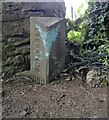
Old Boundary Marker off the B3128, Ashton Road
County Boundary Marker on a public footpath off the north side of the B3128 Ashton Road near the Ashton PH, Bower Ashton. On the boundary of Long Ashton parish and Bristol since 1951 but formerly entirely in Long Ashton parish, Somerset. Milestone Society National ID: SO_LASBRI03cb
Image: © Roadside Relics Taken: 3 Jun 2019
0.02 miles
6
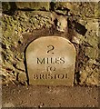
Modern Milestone by the B3128, Ashton Road, Long Ashton, Somerset
Carved stone post by the B3128 (was A370), in parish of LONG ASHTON (NORTH SOMERSET District), 50m East of "The Dovecote" PH, built into wall, on South side of road. Original was a Bristol iron plate, erected by the Bristol turnpike trust in the 18th century. This stone was erected in the 20th Century. Inscription reads:- : 2 / MILES / TO / BRISTOL : Milestone Society National ID: SO_BRWS02.
Image: © M Faherty Taken: 19 Jul 2011
0.03 miles
7
Footpath
Bower Ashton
Image: © Anthony O'Neil Taken: 27 Jan 2022
0.04 miles
8
The Dovecote pub near Ashton Court, Bristol
Image: © Anthony O'Neil Taken: 13 Mar 2011
0.04 miles
9
Lockdown before Lockdown
Ashton Court
Image: © Anthony O'Neil Taken: 21 Apr 2020
0.06 miles
10
New Protocol
North Somerset Bus Services
Image: © Anthony O'Neil Taken: 21 Apr 2020
0.07 miles
  • ...