IMAGES TAKEN NEAR TO
Northwick, Dundry, BRISTOL, BS41 8NN
Introduction
This page details the photographs taken nearby to BS41 8NN by members of the Geograph project.
The Geograph project started in 2005 with the aim of publishing, organising and preserving representative images for every square kilometre of Great Britain, Ireland and the Isle of Man.

There are currently over 7.5m images from over14,400 individuals and you can help contribute to the project by visiting https://www.geograph.org.uk
Image Map
Images are licensed for reuse under creativecommons.org/licenses/by-sa/2.0
Notes
- Clicking on the map will re-center to the selected point.
- The higher the marker number, the further away the image location is from the centre of the postcode.
Image Listing (14 Images Found)
Images are licensed for reuse under creativecommons.org/licenses/by-sa/2.0
Image
Details
Distance
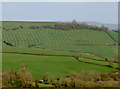
1
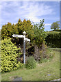
Dundry beckons
A choice of either the Upton Lane or the North Wick Road to get to the village.
Image: © Neil Owen
Taken: 21 May 2015
0.01 miles
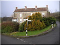
2
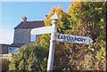
Direction Sign - Signpost by Northwick Road, North Wick
Pyramid finial - 2 arms; Somerset SCC pyramid by the UC road, in parish of Chew Magna (Bath and North East Somerset District), Upton Lane junction with Northwick Road, North Wick.
Surveyed
Milestone Society National ID: SO_ST5865.
Image: © Milestone Society
Taken: 9 Feb 2015
0.01 miles
4
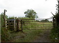
Footpath and farm gate
Follow the footpath from Chew Magna and you can walk over the hill to arrive here at North Wick.
Image: © Neil Owen
Taken: 3 Jul 2010
0.03 miles
5
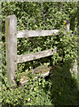
Not quite the road to nowhere
This stile bears footpath markers but it appears to be somewhat impractical now.
Image: © Neil Owen
Taken: 21 May 2015
0.05 miles
7
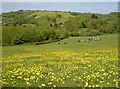
Buttercups for the butter producers
Late May and the farm fields are filling with golden buttercups. Will the flowers make for a rich cream?
Image: © Neil Owen
Taken: 21 May 2015
0.11 miles
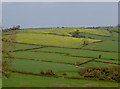
8
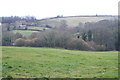
2012 : Along the southern slopes of Dundry Hill
Seen from Northwick Road.
North Wick is on the right hand edge.
The road steadily climbs this side of Dundry Hill to reach Rattledown Farm just below the top at the left hand end of the ridge ahead. Am sure there will be a good view from there.
Image: © Maurice Pullin
Taken: 25 Mar 2012
0.12 miles
9
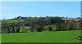
The colour coming through
The Spring starts to work its magic in the countryside.
Image: © Neil Owen
Taken: 9 Apr 2014
0.17 miles
10
Stripy lines
It's the sort of style you would expect of a sports ground, but this is farmland. Still, it helps to enhance the contouring.
Image: © Neil Owen
Taken: 9 Apr 2014
0.17 miles