IMAGES TAKEN NEAR TO
Currells Lane, BRISTOL, BS40 9XF
Introduction
This page details the photographs taken nearby to Currells Lane, BS40 9XF by members of the Geograph project.
The Geograph project started in 2005 with the aim of publishing, organising and preserving representative images for every square kilometre of Great Britain, Ireland and the Isle of Man.

There are currently over 7.5m images from over14,400 individuals and you can help contribute to the project by visiting https://www.geograph.org.uk
Image Map
Images are licensed for reuse under creativecommons.org/licenses/by-sa/2.0
Notes
- Clicking on the map will re-center to the selected point.
- The higher the marker number, the further away the image location is from the centre of the postcode.
Image Listing (52 Images Found)
Images are licensed for reuse under creativecommons.org/licenses/by-sa/2.0
Image
Details
Distance
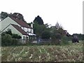
1
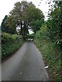
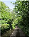
Currells Lane
Looking east towards Newditch Lane.
Image: © Thomas Nugent
Taken: 19 Oct 2009
0.03 miles
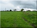
2
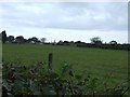
Field off Currells Lane
Near the junction with Newditch Lane.
Image: © Thomas Nugent
Taken: 19 Oct 2009
0.03 miles
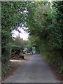
3
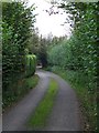
Currells Lane
Bends and high hedges make this a challenging road for the pedestrian.
Image: © Thomas Nugent
Taken: 19 Oct 2009
0.04 miles
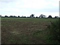
4
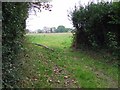
Field off Currells Lane
On the south side of the Potters Hill end of the lane.
Image: © Thomas Nugent
Taken: 19 Oct 2009
0.06 miles
5
Trimming the hedges
The tractor is trimming the hedges in this recently harvested field off Newditch Lane.
Image: © Thomas Nugent
Taken: 19 Oct 2009
0.08 miles
6
Field near Potters Hill
By the A38 opposite Freemans Quarry.
Image: © Thomas Nugent
Taken: 27 Apr 2009
0.08 miles
7
Harvested field
Off Newditch Lane at Currells Lane.
Image: © Thomas Nugent
Taken: 19 Oct 2009
0.09 miles
8
Currells Lane
Looking west from the junction with Newditch Lane.
Image: © Thomas Nugent
Taken: 19 Oct 2009
0.09 miles
9
Currells Lane
The lane runs close to the southern edge of the square. Image] looks in the other direction.
Image: © Derek Harper
Taken: 30 May 2015
0.09 miles
10
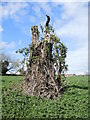
Decaying tree near Felton Vicarage
A skeletal stump, slowly becoming shrouded.
Image: © Neil Owen
Taken: 18 Apr 2022
0.09 miles