IMAGES TAKEN NEAR TO
Lower Hounsley, Winford, BRISTOL, BS40 8BP
Introduction
This page details the photographs taken nearby to BS40 8BP by members of the Geograph project.
The Geograph project started in 2005 with the aim of publishing, organising and preserving representative images for every square kilometre of Great Britain, Ireland and the Isle of Man.

There are currently over 7.5m images from over14,400 individuals and you can help contribute to the project by visiting https://www.geograph.org.uk
Image Map (Loading...)


Getting Data...Please wait
Leaflet Map data © OpenStreetMap
Images are licensed for reuse under creativecommons.org/licenses/by-sa/2.0
Notes
- Clicking on the map will re-center to the selected point.
- The higher the marker number, the further away the image location is from the centre of the postcode.
Image Listing (21 Images Found)
Images are licensed for reuse under creativecommons.org/licenses/by-sa/2.0
Image
Details
Distance
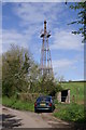
1
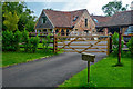
Winford : Walnut Tree Barn
Looking towards Walnut Tree Barn.
Image: © Lewis Clarke
Taken: 23 Jul 2020
0.03 miles
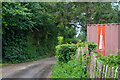
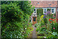
2
Winford : Whitling Street
Looking along Whitling Street.
Image: © Lewis Clarke
Taken: 23 Jul 2020
0.06 miles
3
Late afternoon bonfire
Smoke from the bonfire backlit by the warm August sun.
Image: © Neil Owen
Taken: 8 Aug 2010
0.07 miles
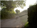
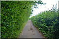
4
Cock and Yew Tree Hill
This short road will take you to Whitling Street and onto Lower Strode.
Image: © Neil Owen
Taken: 8 Aug 2010
0.08 miles
6
Winford : Whitling Street
Looking along Whitling Street.
Image: © Lewis Clarke
Taken: 23 Jul 2020
0.08 miles
7
Winford : Whitling Street
Looking along Whitling Street.
Image: © Lewis Clarke
Taken: 23 Jul 2020
0.09 miles
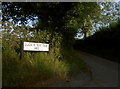
8
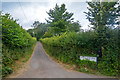
Winford : Cock and Yew Tree Hill
Looking along Cock and Yew Tree Hill.
Image: © Lewis Clarke
Taken: 23 Jul 2020
0.09 miles
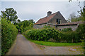
9
Winford : South View
Looking towards South View.
Image: © Lewis Clarke
Taken: 23 Jul 2020
0.10 miles
10
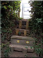
Step this way
A nice flight of wooden steps to the footpath; the path actually crosses the Monarch's Way path and links the villages of Regil with Chew Stoke.
Image: © Neil Owen
Taken: 8 Aug 2010
0.10 miles