IMAGES TAKEN NEAR TO
Butcombe, BRISTOL, BS40 7XG
Introduction
This page details the photographs taken nearby to BS40 7XG by members of the Geograph project.
The Geograph project started in 2005 with the aim of publishing, organising and preserving representative images for every square kilometre of Great Britain, Ireland and the Isle of Man.

There are currently over 7.5m images from over14,400 individuals and you can help contribute to the project by visiting https://www.geograph.org.uk
Image Map (Loading...)


Getting Data...Please wait
Leaflet Map data © OpenStreetMap
Images are licensed for reuse under creativecommons.org/licenses/by-sa/2.0
Notes
- Clicking on the map will re-center to the selected point.
- The higher the marker number, the further away the image location is from the centre of the postcode.
Image Listing (7 Images Found)
Images are licensed for reuse under creativecommons.org/licenses/by-sa/2.0
Image
Details
Distance
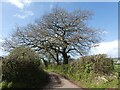
1
Lane near Cherry Tree Cottage
The grass down the middle suggests that this is a little-used lane.
Image: © Derek Harper
Taken: 30 May 2015
0.08 miles
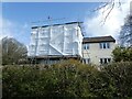
3
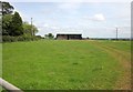
Shed near Bicknell Farm
Across a pasture from the lane shown in Image
Image: © Derek Harper
Taken: 30 May 2015
0.13 miles
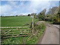
4
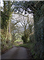
Sutton Lane
The foliage wraps around the lane as it drops down to Rustin Farm, framing the foothills of the Mendips.
Image: © Neil Owen
Taken: 6 Mar 2012
0.17 miles