IMAGES TAKEN NEAR TO
Long Lane, BRISTOL, BS40 5SF

Introduction

This page details the photographs taken nearby to Long Lane, BS40 5SF by members of the Geograph project.

The Geograph project started in 2005 with the aim of publishing, organising and preserving representative images for every square kilometre of Great Britain, Ireland and the Isle of Man.

There are currently over 7.5m images from over14,400 individuals and you can help contribute to the project by visiting https://www.geograph.org.uk

Image Map


Images are licensed for reuse under creativecommons.org/licenses/by-sa/2.0
Notes
  • Clicking on the map will re-center to the selected point.
  • The higher the marker number, the further away the image location is from the centre of the postcode.

Image Listing (23 Images Found)

Images are licensed for reuse under creativecommons.org/licenses/by-sa/2.0
  • ...
Image
Details
Distance
1
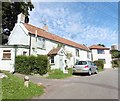
Cottage on Long Lane
Image: © Roger Cornfoot Taken: 26 Aug 2020
0.00 miles
2
Old Direction Sign - Signpost by Church Road, Redhill, Wrington Parish
Pyramid finial - 2 arms; Somerset SCC pyramid by the UC road, in parish of Wrington (North Somerset District), Church Road junction with The Pound and Long Lane, Redhill. Surveyed Milestone Society National ID: SO_ST4963.
Image: © Milestone Society Taken: Unknown
0.01 miles
3
Redhill, North Somerset
This delightful little village lies on the southern slopes below Bristol International Airport and overlooks the Mendip Hills.
Image: © FollowMeChaps Taken: 2 Jan 2006
0.04 miles
4
The Old Post Office Redhill
Image: © Dave Beynon Taken: 21 Jul 2007
0.06 miles
5
Redhill village and church
Image: © FollowMeChaps Taken: 2 Jan 2006
0.06 miles
6
Lane, hedge, tree and Mette cycling
Another beautiful, warm Spring day, cycling towards Redhill.
Image: © Nick Warner Taken: 22 Mar 2009
0.09 miles
7
Christ Church, Redhill
An open door indicating a friendly welcome? The village 'chapel of ease' was built in 1843 by James Wilson in Lancet style. It is now an English heritage Grade II listed building. See Image] for a fine old benchmark.
Image: © Neil Owen Taken: 23 Jan 2012
0.09 miles
8
Western end of Christ Church, Redhill
The doorway was blocked off some time ago, but a fine bolt benchmark remains beside it. See Image] for a closer look.
Image: © Neil Owen Taken: 23 Jan 2012
0.10 miles
9
An ivy boltmark
The church at Redhill has a fine 1GL boltmark in the western end, despite the encroaching vegetation. See http://www.bench-marks.org.uk/bm41076 for the entry in the Benchmark Database for more information on this survey mark, made as part of the Bristol to Plymouth line of 1849. Also see Image] for a wider view of the location.
Image: © Neil Owen Taken: 23 Jan 2012
0.10 miles
10
Christ Church, Redhill
Image: © Roger Cornfoot Taken: 26 Aug 2020
0.10 miles
  • ...