IMAGES TAKEN NEAR TO
Long Lane, BRISTOL, BS40 5SB
Introduction
This page details the photographs taken nearby to Long Lane, BS40 5SB by members of the Geograph project.
The Geograph project started in 2005 with the aim of publishing, organising and preserving representative images for every square kilometre of Great Britain, Ireland and the Isle of Man.

There are currently over 7.5m images from over14,400 individuals and you can help contribute to the project by visiting https://www.geograph.org.uk
Image Map (Loading...)


Getting Data...Please wait
Leaflet Map data © OpenStreetMap
Images are licensed for reuse under creativecommons.org/licenses/by-sa/2.0
Notes
- Clicking on the map will re-center to the selected point.
- The higher the marker number, the further away the image location is from the centre of the postcode.
Image Listing (6 Images Found)
Images are licensed for reuse under creativecommons.org/licenses/by-sa/2.0
Image
Details
Distance
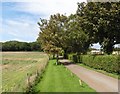
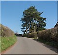
2
Road to Hortswood and Burnt House Farms
Image: © Roger Cornfoot
Taken: 26 Aug 2020
0.08 miles
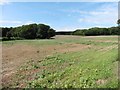
4
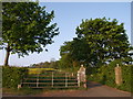
Drive to Burnt House Farm
A division of footpaths a little way up the hill above Long Lane. The path running up the drive to the farm beside the oil rape field continues to Cottage Farm; the lane on the left is carrying a footpath past Little Horts Wood.
Image: © Derek Harper
Taken: 4 May 2007
0.10 miles