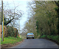
IMAGES TAKEN NEAR TO
Goldcross, BRISTOL, BS39 4DL

Introduction

This page details the photographs taken nearby to Goldcross, BS39 4DL by members of the Geograph project.

The Geograph project started in 2005 with the aim of publishing, organising and preserving representative images for every square kilometre of Great Britain, Ireland and the Isle of Man.

There are currently over 7.5m images from over14,400 individuals and you can help contribute to the project by visiting https://www.geograph.org.uk

Image Map


Images are licensed for reuse under creativecommons.org/licenses/by-sa/2.0
Notes
  • Clicking on the map will re-center to the selected point.
  • The higher the marker number, the further away the image location is from the centre of the postcode.

Image Listing (11 Images Found)

Images are licensed for reuse under creativecommons.org/licenses/by-sa/2.0
Image
Details
Distance
1
2012 : Road past Stowey Cottage
On the right. The waterworks is on the left. A few hundred yards to the A368.
Image: © Maurice Pullin Taken: 25 Mar 2012
0.04 miles
2
2012 : Minor road near Gold's Cross
Joins Chew Magna (2 miles behind) to the A368, a few hundred yards to go. Passing a waterworks treatment plant to the left.
Image: © Maurice Pullin Taken: 25 Mar 2012
0.07 miles
3
2012 : Waterworks at Gold's Cross
Seen through the main gate. Probably associated with the nearby Chew Valley Lake.
Image: © Maurice Pullin Taken: 25 Mar 2012
0.07 miles
4
Stowey Water Treatment Works
Image: © Richard Park Taken: Unknown
0.08 miles
5
Stowey Water Treatment Works
Image: © Richard Park Taken: Unknown
0.09 miles
6
Road closure warning
Image: © Rob Purvis Taken: 21 May 2011
0.10 miles
7
2012 : Gold's Cross on the minor road to Chew Magna
Turn left for Bishop Sutton, right to Moorledge and Stanton Drew.
Image: © Maurice Pullin Taken: 25 Mar 2012
0.13 miles
8
2012 : Moorledge Lane arrives at Gold's Cross
This way to Moorledge and Stanton Drew. Dundry Hill is in the distance.
Image: © Maurice Pullin Taken: 25 Mar 2012
0.13 miles
9
Moorledge Lane
Image: © Rob Purvis Taken: 21 May 2011
0.14 miles
10
Direction Sign - Signpost on the A368 at Knighton Sutton Farm
Pyramid finial - 4 arms; Somerset SCC pyramid by the A368, in parish of Stowey Sutton (Bath And North East Somerset District), at Knighton Sutton Farm. surveyed Milestone Society National ID: SO_ST5960A
Image: © Milestone Society Taken: Unknown
0.20 miles