IMAGES TAKEN NEAR TO
Stanton Wick, Pensford, BRISTOL, BS39 4DA
Introduction
This page details the photographs taken nearby to BS39 4DA by members of the Geograph project.
The Geograph project started in 2005 with the aim of publishing, organising and preserving representative images for every square kilometre of Great Britain, Ireland and the Isle of Man.

There are currently over 7.5m images from over14,400 individuals and you can help contribute to the project by visiting https://www.geograph.org.uk
Image Map
Images are licensed for reuse under creativecommons.org/licenses/by-sa/2.0
Notes
- Clicking on the map will re-center to the selected point.
- The higher the marker number, the further away the image location is from the centre of the postcode.
Image Listing (14 Images Found)
Images are licensed for reuse under creativecommons.org/licenses/by-sa/2.0
Image
Details
Distance
1
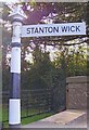
Old Direction Sign - Signpost by the A368, Stanton Drew
Pyramid finial - 1 arm; Somerset SCC pyramid by the A368, in parish of Stanton Drew (Bath and North East Somerset District), Stanton Wick Lane junction.
Surveyed
Milestone Society National ID: SO_ST6161
Image: © Milestone Society
Taken: Unknown
0.03 miles
2
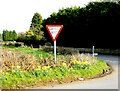
2009 : A368 at the Stanton Wick junction
With a pleasing display of daffodils.
Image: © Maurice Pullin
Taken: 15 Mar 2009
0.03 miles
4
Footpath near Stanton Wick Farm
The path looks like it was a popular one when the crop was high.
Image: © Neil Owen
Taken: 17 Sep 2021
0.10 miles
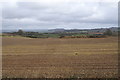
5
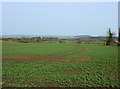
2009 : Oil seed rape at an early stage
In a field off the A368 near Stanton Wick. At this time of year (march) if it looks like cabbage it is oil seed rape.
On the skyline left of centre a clump of trees marks the position of Kelston Round Hill Image and in the original image to the right of that it is possible to see Beckford's Tower on Lansdown Image
Image: © Maurice Pullin
Taken: 15 Mar 2009
0.11 miles
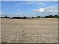
6
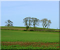
2009 : Farmland and trees near Stanton Wick
Image: © Maurice Pullin
Taken: 15 Mar 2009
0.12 miles
7
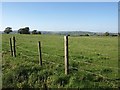
Meadowland beside the A368, opposite the entrance to Stanton Wick Farm
Image: © David Gearing
Taken: 28 Sep 2011
0.14 miles
8
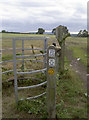
Different signs of the times
A variation on the type of footpath marker here. The paths are easily accessed as the field gate is left open.
Image: © Neil Owen
Taken: 31 Jul 2018
0.17 miles
9

Golden rows
Some unusually dry weather this summer has led to early ripening and gathering.
Image: © Neil Owen
Taken: 31 Jul 2018
0.19 miles
10

No calls, but some good stories
As with many a village telephone box, this one at Stanton Wick has been disconnected. Instead a handy village notice board and small library has taken over the use.
Image: © Neil Owen
Taken: 31 Jul 2018
0.20 miles