IMAGES TAKEN NEAR TO
Hillcrest, BRISTOL, BS39 4BD
Introduction
This page details the photographs taken nearby to Hillcrest, BS39 4BD by members of the Geograph project.
The Geograph project started in 2005 with the aim of publishing, organising and preserving representative images for every square kilometre of Great Britain, Ireland and the Isle of Man.

There are currently over 7.5m images from over14,400 individuals and you can help contribute to the project by visiting https://www.geograph.org.uk
Image Map
Images are licensed for reuse under creativecommons.org/licenses/by-sa/2.0
Notes
- Clicking on the map will re-center to the selected point.
- The higher the marker number, the further away the image location is from the centre of the postcode.
Image Listing (17 Images Found)
Images are licensed for reuse under creativecommons.org/licenses/by-sa/2.0
Image
Details
Distance
1
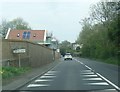
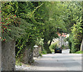
2010 : Pensford Old Road
As the name suggests this is the old road through Pensford before the coming of the A37.
Image: © Maurice Pullin
Taken: 16 Aug 2010
0.05 miles
2
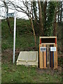
Where there's muck...
A local parish rubbish bin is a business opportunity for a local firm.
Image: © Neil Owen
Taken: 5 Mar 2021
0.08 miles
3
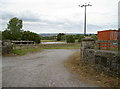
Entrance to Leigh Farm
Farm with pond and freight container.
Image: © Neil Owen
Taken: 11 Jul 2010
0.10 miles
4
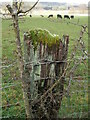
A fencepost with accessories
Taking the path off Old Road and passing the cattle field brings this sight.
Image: © Neil Owen
Taken: 26 Mar 2021
0.13 miles
5
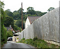
2010 : Turning off Pensford Old Road
Not a pretty sight but it is there, for all we know it could be hiding something worse.
Image: © Maurice Pullin
Taken: 16 Aug 2010
0.14 miles
6
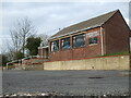
Pensford Gospel Hall
Pensford's gospel faith really begins in the early twentieth century, when people would gather to read and worship in significant numbers. Missions from Bristol made visits and held oepn-air meetings near the viaduct. Soon, tents were used too, then a wooden hut which served for a time. However, when the movement gathered enough momentum a couple of old cottages on Old Road were purchased and demolished in 1958; this Gospel Hall became the meeting place and remains so today.
Update Feb '23: the hall has closed as a place of worship and planning permission to convert it into residential use has been approved.
Image: © Neil Owen
Taken: 5 Mar 2021
0.15 miles
8
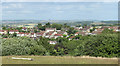
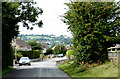
2010 : East from Wick Lane, Pensford
Housing south of Pensford is on the other side of the valley.
On the skyline left of centre a clump of trees marks Kelston Round Hill Image
Image: © Maurice Pullin
Taken: 5 Jul 2010
0.18 miles
9
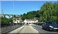
2010 : Down the hill into Pensford
Along High Street. This really was Pensford's main road in former days.
Image: © Maurice Pullin
Taken: 16 Aug 2010
0.19 miles