IMAGES TAKEN NEAR TO
Kent Avenue, BRISTOL, BS37 7RY
Introduction
This page details the photographs taken nearby to Kent Avenue, BS37 7RY by members of the Geograph project.
The Geograph project started in 2005 with the aim of publishing, organising and preserving representative images for every square kilometre of Great Britain, Ireland and the Isle of Man.

There are currently over 7.5m images from over14,400 individuals and you can help contribute to the project by visiting https://www.geograph.org.uk
Image Map
Images are licensed for reuse under creativecommons.org/licenses/by-sa/2.0
Notes
- Clicking on the map will re-center to the selected point.
- The higher the marker number, the further away the image location is from the centre of the postcode.
Image Listing (9 Images Found)
Images are licensed for reuse under creativecommons.org/licenses/by-sa/2.0
Image
Details
Distance
1
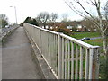
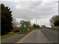
Roads going over and under
Where Greenways Road crosses Goose Green Way, due to an overbridge traffic can travel completely freely along both routes at the same time, whilst in each case pedestrians are kept safely separated from vehicles.
Image: © Ruth Riddle
Taken: 10 Dec 2011
0.10 miles
6
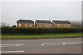
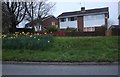
Houses on Goose Green Way, Yate
The fronts are on Corbett Close next to the main road.
Image: © David Howard
Taken: 14 Mar 2020
0.17 miles