1
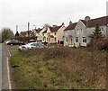
Westmorland Terrace houses, Old Sodbury
The houses are alongside the B4040 in the east of the village.
Image: © Jaggery
Taken: 24 Nov 2013
0.01 miles
2
Westmorland Terrace
Houses on the B4040, Old Sodbury.
Image: © JThomas
Taken: 14 Jul 2019
0.02 miles
3
Snowdrops by the Cross Hands
Some seasonal showing on the B4040.
Image: © Neil Owen
Taken: 12 Feb 2018
0.02 miles
4
Western end of Westmorland Terrace, Old Sodbury
Westmorland Terrace is a 100 metre long row of semi-detached houses alongside the B4040 in the east of the village.
Image: © Jaggery
Taken: 24 Nov 2013
0.04 miles
5
Two-way traffic ahead on the B4040 in Old Sodbury
Vehicles travelling towards the camera must turn into the Cross Hands car park http://www.geograph.org.uk/photo/3756059 here.
Vehicles for the A46 should have taken the left fork here. http://www.geograph.org.uk/photo/3756032
Image: © Jaggery
Taken: 24 Nov 2013
0.05 miles
6
Eastern edge of Old Sodbury
The B4040 from Acton Turville reaches Old Sodbury, a small village in South Gloucestershire.
The speed limit reduces from 50mph to 40mph.
Image: © Jaggery
Taken: 24 Nov 2013
0.05 miles
7
Western end of the B4040 in Old Sodbury
The B4040 is a long rural road, mostly in Wiltshire. Its western end is here in South Gloucestershire. The grass triangle is the point where the road splits in two. The two arms of the B4040 meet the A46 about 90 metres apart ahead. One-way traffic applies on each arm, except that access to the Cross Hands car park is allowed via the arm on the right. http://www.geograph.org.uk/photo/3756035
Image: © Jaggery
Taken: 24 Nov 2013
0.06 miles
8
Southern arm of the B4040 in Old Sodbury
Traffic flow here is one-way, towards the camera. Viewed from the A46 Bath Road junction looking towards this http://www.geograph.org.uk/photo/3756032 triangular junction where the two arms of the B4040 meet.
Image: © Jaggery
Taken: 24 Nov 2013
0.06 miles
9
Entering Old Sodbury
On the B4040.
Image: © JThomas
Taken: 14 Jul 2019
0.07 miles
10
Hillside grazing near Old Sodbury
Off the B4040.
Image: © JThomas
Taken: 14 Jul 2019
0.08 miles


