1
Quarry Road entrance to Hanson site, Chipping Sodbury
Hanson UK produce aggregates (crushed rock, sand and gravel), ready-mixed and precast concrete, asphalt, cement and cement-related materials, bricks and a range of building products. Hanson UK is part of the HeidelbergCement Group, one of the largest building materials manufacturers in the world and the global market leader in aggregates.
Image: © Jaggery
Taken: 10 Oct 2012
0.04 miles
2
Quarry traffic only, Quarry Road, Chipping Sodbury
The sign on the right is on the corner of Mill Lane. Quarry Road ahead leads to the Hanson site. http://www.geograph.org.uk/photo/3578004
Image: © Jaggery
Taken: 10 Oct 2012
0.04 miles
3
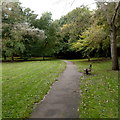
Bench alongside the Frome Valley Walkway, Chipping Sodbury
This parklike section of the walkway is between Brook Street and Mill Lane.
Image: © Jaggery
Taken: 10 Oct 2012
0.05 miles
4
Ridgewood and the quarry, cheek by jowl
Despite the heavy industry right beside it, the Ridgewood trail includes some delicate habitats. The route takes in much of the western half of the narrow, stony ridge to the north of Chipping Sodbury.
Image: © Neil Owen
Taken: 31 May 2012
0.06 miles
5
The Frome Valley Walkway
The entrance off Quarry Road into the small meadow running alongside the river, with a barrier to prevent motor vehicles.
Image: © Neil Owen
Taken: 31 May 2012
0.07 miles
6
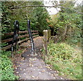
Bridge to the Frome Valley Walkway, Chipping Sodbury
The wooden footbridge across the River Frome leads to the Frome Valley Walkway.
Viewed from Mill Lane. The River Frome is one of several rivers of that name in the SW of England. Frome is derived from an Old English word meaning fair, fine or brisk, describing the flow of a river.
Image: © Jaggery
Taken: 10 Oct 2012
0.07 miles
7
The Kingfisher points the way
A suitably shaped signpost at the eastern end of the Frome Valley Walkway, just off Brook Street.
Image: © Neil Owen
Taken: 31 May 2012
0.07 miles
8
Brook Street entrance to the Frome Valley Walkway, Chipping Sodbury
This part of the Frome Valley Walkway is from Brook Street to Mill Lane.
Image: © Jaggery
Taken: 10 Oct 2012
0.08 miles
9
River Frome, Chipping Sodbury
Viewed from Mill Lane. This River Frome is one of several rivers of that name in the SW of England. Frome is derived from an Old English word meaning fair, fine or brisk, describing the flow of a river.
Image: © Jaggery
Taken: 10 Oct 2012
0.08 miles
10
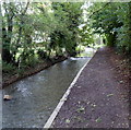
Towards Brook Street from the Frome Valley Walkway, Chipping Sodbury
This part of the Frome Valley Walkway is from Mill Lane to Brook Street.
Image: © Jaggery
Taken: 10 Oct 2012
0.08 miles


