IMAGES TAKEN NEAR TO
Keens Grove, BRISTOL, BS35 4LW
Introduction
This page details the photographs taken nearby to Keens Grove, BS35 4LW by members of the Geograph project.
The Geograph project started in 2005 with the aim of publishing, organising and preserving representative images for every square kilometre of Great Britain, Ireland and the Isle of Man.

There are currently over 7.5m images from over14,400 individuals and you can help contribute to the project by visiting https://www.geograph.org.uk
Image Map
Images are licensed for reuse under creativecommons.org/licenses/by-sa/2.0
Notes
- Clicking on the map will re-center to the selected point.
- The higher the marker number, the further away the image location is from the centre of the postcode.
Image Listing (31 Images Found)
Images are licensed for reuse under creativecommons.org/licenses/by-sa/2.0
Image
Details
Distance
1
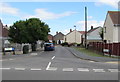
Vicarage Road, Pilning, South Gloucestershire
From the B4064 Redwick Road, Vicarage Road leads to Keen's Grove and Chessell Avenue.
Image: © Jaggery
Taken: 13 Sep 2018
0.05 miles
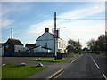
2
Vicarage Road telecoms cabinets, Pilning, South Gloucestershire
The two dark green cabinets are on the left here https://www.geograph.org.uk/photo/5904457 near the corner of the B4064 Redwick Road.
Image: © Jaggery
Taken: 13 Sep 2018
0.06 miles
3
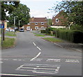
Wick Road, Redwick, South Gloucestershire
Cul-de-sac on the NE side of the B4064 Redwick Road.
Image: © Jaggery
Taken: 13 Sep 2018
0.06 miles
4
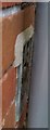
Ordnance Survey Flush Bracket (S1449)
This OS Flush Bracket can be found on No63 Redwick Road. It marks a point 6.723m above mean sea level.
Image: © Adrian Dust
Taken: 16 Jan 2020
0.06 miles
5
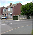
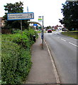
Redwick Road Pumping Station, Pilning, South Gloucestershire
The Wessex Water identifier on the brick & metal structure on the right is
15180 REDWICK ROAD, PILNING PUMPING STATION.
Image: © Jaggery
Taken: 13 Sep 2018
0.07 miles

8
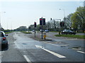
Cross Hands and Easter Compton direction and distances sign, Redwick, South Gloucestershire
Alongside the B4064 Redwick Road a quarter of a mile from Cross Hands, two and a half miles from Easter Compton. The sign is not perpendicular in September 2018, perhaps caused by a vehicle collision.
Image: © Jaggery
Taken: 13 Sep 2018
0.08 miles
10
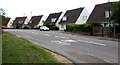
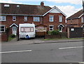
Low-pitched roofs, Redwick Road, Pilning
Houses viewed across the B4064 Redwick Road from the corner of Vicarage Road.
Image: © Jaggery
Taken: 13 Sep 2018
0.11 miles