IMAGES TAKEN NEAR TO
Aust Road, BRISTOL, BS35 4AS

Introduction

This page details the photographs taken nearby to Aust Road, BS35 4AS by members of the Geograph project.

The Geograph project started in 2005 with the aim of publishing, organising and preserving representative images for every square kilometre of Great Britain, Ireland and the Isle of Man.

There are currently over 7.5m images from over14,400 individuals and you can help contribute to the project by visiting https://www.geograph.org.uk

Image Map


Images are licensed for reuse under creativecommons.org/licenses/by-sa/2.0
Notes
  • Clicking on the map will re-center to the selected point.
  • The higher the marker number, the further away the image location is from the centre of the postcode.

Image Listing (26 Images Found)

Images are licensed for reuse under creativecommons.org/licenses/by-sa/2.0
  • ...
Image
Details
Distance
1
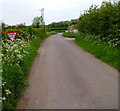
Aust Road, Priestpool
Image: © David Howard Taken: 23 May 2020
0.04 miles
2
Old-style distances sign, Priestpool
Alongside Aust Road on the approach to the Ingst Road junction.
Image: © Jaggery Taken: 20 May 2012
0.04 miles
3
Aust Road, Priestpool
Aust Road heads away from the Ingst Road junction on the left. Ahead are the village of Aust and the Old Severn Bridge.
Image: © Jaggery Taken: 20 May 2012
0.04 miles
4
Old road sign
This old direction sign, showing the side turning to Ingst, is on the Aust Road near to Priestpool farm, which may be seen in the background of the picture.
Image: © Ruth Riddle Taken: 19 Feb 2011
0.06 miles
5
Cycle route signpost near Elberton, South Gloucestershire
At the junction of Ingst Road and Aust Road.
Image: © Jaggery Taken: 20 May 2012
0.08 miles
6
Ingst Road near Elberton, South Gloucestershire
The Give Way sign is near the NE end of Ingst Road, on the approach to the Aust Road junction.
Image: © Jaggery Taken: 20 May 2012
0.09 miles
7
Ingst Road, Priestpool
Viewed from Aust Road.
Image: © Jaggery Taken: 20 May 2012
0.11 miles
8
Harnhill Landfill Site entrance gate near Elberton
South Gloucestershire Council site viewed from Aust Road.
Image: © Jaggery Taken: 20 May 2012
0.11 miles
9
Orange cord securing a field gate, Priestpool
On the north side of Aust Road.
Image: © Jaggery Taken: 20 May 2012
0.15 miles
10
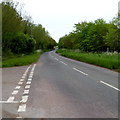
Aust Road SE of the Harnhill Landfill Site entrance near Elberton
The broken double white lines are at the edge of the road to these http://www.geograph.org.uk/photo/4240962 entrance gates.
Image: © Jaggery Taken: 20 May 2012
0.16 miles
  • ...