IMAGES TAKEN NEAR TO
Gloucester Road, BRISTOL, BS35 3SA
Introduction
This page details the photographs taken nearby to Gloucester Road, BS35 3SA by members of the Geograph project.
The Geograph project started in 2005 with the aim of publishing, organising and preserving representative images for every square kilometre of Great Britain, Ireland and the Isle of Man.

There are currently over 7.5m images from over14,400 individuals and you can help contribute to the project by visiting https://www.geograph.org.uk
Image Map (Loading...)


Getting Data...Please wait
Leaflet Map data © OpenStreetMap
Images are licensed for reuse under creativecommons.org/licenses/by-sa/2.0
Notes
- Clicking on the map will re-center to the selected point.
- The higher the marker number, the further away the image location is from the centre of the postcode.
Image Listing (11 Images Found)
Images are licensed for reuse under creativecommons.org/licenses/by-sa/2.0
Image
Details
Distance
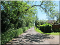
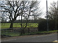
3
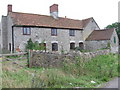
Garden needs attention
Presumably uninhabited house. The right of way runs along the far side of it.
Image: © William Avery
Taken: 8 Oct 2006
0.17 miles
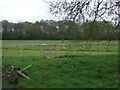
4
Looking east along the right of way
The derelict byre looks like part of a lorry that was recycled.
Image: © William Avery
Taken: 8 Oct 2006
0.17 miles
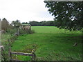
5
Stile to Public Footpath
The start of the public footpath from the A38 to Tockington Park Farm.
Image: © Ruth Riddle
Taken: 14 Jan 2012
0.17 miles
7
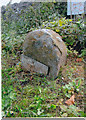
Old Milestone by the A38, Gloucester Road, Alveston Parish
Metal plate attached to stone post by the A38, in parish of ALVESTON (SOUTH GLOUCESTERSHIRE District), North of entrance to Tockington Park Farm, on embankment. Erected by the Bristol turnpike trust in the 19th century.
Inscription reads:- : Bristol / 8 :
Milestone Society National ID: GL_BRGL08.
Image: © R Shackell
Taken: 27 Sep 2013
0.21 miles
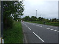
9
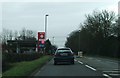
A38 Gloucester Road near Woodhouse Down
The petrol station pictured is one of the closest to junction 15 of the M5 so it tends to be quite busy with people buying fuel before their motorway journeys.
Image: © Ruth Riddle
Taken: 6 Jan 2012
0.24 miles
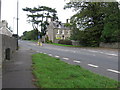
10

Filling station on A38 in Woodhouse Down
Image: © David Smith
Taken: 28 Jul 2012
0.24 miles