IMAGES TAKEN NEAR TO
Forty Acre Lane, BRISTOL, BS35 3QU
Introduction
This page details the photographs taken nearby to Forty Acre Lane, BS35 3QU by members of the Geograph project.
The Geograph project started in 2005 with the aim of publishing, organising and preserving representative images for every square kilometre of Great Britain, Ireland and the Isle of Man.

There are currently over 7.5m images from over14,400 individuals and you can help contribute to the project by visiting https://www.geograph.org.uk
Image Map (Loading...)


Getting Data...Please wait
Leaflet Map data © OpenStreetMap
Images are licensed for reuse under creativecommons.org/licenses/by-sa/2.0
Notes
- Clicking on the map will re-center to the selected point.
- The higher the marker number, the further away the image location is from the centre of the postcode.
Image Listing (12 Images Found)
Images are licensed for reuse under creativecommons.org/licenses/by-sa/2.0
Image
Details
Distance
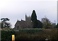
1
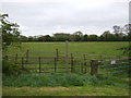
Into the Wolfridge Alpaca site, Alveston, South Gloucestershire
From Forty Acre Lane SE of the A38 Gloucester Road.
The Wolfridge Alpaca nameboard https://www.geograph.org.uk/photo/7646164 is on the right.
Image: © Jaggery
Taken: 5 Nov 2023
0.13 miles
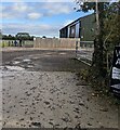
2
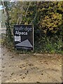
Wolfridge Alpaca nameboard, Alveston, South Gloucestershire
Alongside Forty Acre Lane SE of the A38 Gloucester Road.
Text on the board in November 2023 includes
"Please do not park in the lane - Thank you"
Image: © Jaggery
Taken: 5 Nov 2023
0.13 miles
3
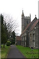
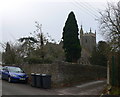
Alveston church
St Helens.
Looking SW from position
Image: © Iain Macaulay
Taken: 20 Dec 2005
0.16 miles
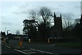
6

Alveston War Memorial
Outside St Helen's Church.
Image: © JThomas
Taken: 11 May 2013
0.20 miles
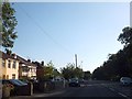
7
Junction of Greenhill Road and A38
The bollards and central reservation reinforce the fact that there is no right turn allowed from the A38 southbound into Greenhill Road in front of St Helen's Church.
Image: © Ruth Riddle
Taken: 4 Jan 2012
0.20 miles
8
Alveston, parish church
St. Helen's, late Victorian church; listed by Historic England (Grade II): http://www.imagesofengland.org.uk/Details/Default.aspx?id=35157&mode=adv
Image: © Mike Faherty
Taken: 19 Mar 2017
0.21 miles
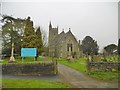
9
St Helen's Church, Alveston
Originally in nearby Rudgeway, St Helens church was torn down in the early 1700s. Its location was then moved to where it is now.
Image: © Eirian Evans
Taken: 17 Feb 2011
0.21 miles