IMAGES TAKEN NEAR TO
Avon Way, BRISTOL, BS35 2DF
Introduction
This page details the photographs taken nearby to Avon Way, BS35 2DF by members of the Geograph project.
The Geograph project started in 2005 with the aim of publishing, organising and preserving representative images for every square kilometre of Great Britain, Ireland and the Isle of Man.

There are currently over 7.5m images from over14,400 individuals and you can help contribute to the project by visiting https://www.geograph.org.uk
Image Map
Images are licensed for reuse under creativecommons.org/licenses/by-sa/2.0
Notes
- Clicking on the map will re-center to the selected point.
- The higher the marker number, the further away the image location is from the centre of the postcode.
Image Listing (11 Images Found)
Images are licensed for reuse under creativecommons.org/licenses/by-sa/2.0
Image
Details
Distance
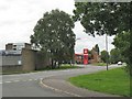
1
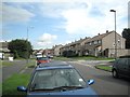
Streamleaze, Thornbury
A residential road some 800m long, curving from south of the town centre to meet Grovesend Road.
Image: © Robin Stott
Taken: 18 Sep 2010
0.07 miles
2
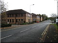
Office buildings by the Thornbury Industrial Estate
On the road which encircles Thornbury to the south.
Image: © David Purchase
Taken: 6 Nov 2016
0.17 miles
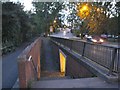
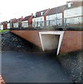
3
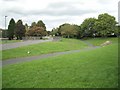
Underpass, Streamleaze, Thornbury
Allows people to walk between open spaces and neighbourhoods without crossing roads - a feature of Thornbury and reminiscent of New Towns such as Redditch. Planning! All is forgiven.
Image: © Robin Stott
Taken: 18 Sep 2010
0.20 miles
4

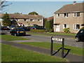
Snowy footpath
Footpath behind Hopkins Close facing south towards Midland Way, Thornbury.
Image: © Charles Drown
Taken: 6 Jan 2010
0.20 miles
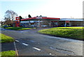
6
Petrol filling station, Gillingstool
Seen from the corner of Knapp Road.
Image: © Robin Stott
Taken: 18 Sep 2010
0.21 miles
8
Murco Thornbury
The Murco filling station is located on the south side of the road named Gillingstool, next door to Thornbury Motors. The Black Horse http://www.geograph.org.uk/photo/3392151 is on the camera side of Gillingstool.
Image: © Jaggery
Taken: 2 Jan 2012
0.23 miles
9
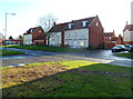
Pearce Close houses, Thornbury
Viewed across the road named Gillingstool.
Image: © Jaggery
Taken: 2 Jan 2012
0.23 miles
10
Gillingstool underpass, Thornbury
Located near the corner of Oakleaze Road, this underpass is beneath the main road named Gillingstool.
Image: © Jaggery
Taken: 2 Jan 2012
0.23 miles