IMAGES TAKEN NEAR TO
St. Mary Street, BRISTOL, BS35 2AA

Introduction

This page details the photographs taken nearby to St. Mary Street, BS35 2AA by members of the Geograph project.

The Geograph project started in 2005 with the aim of publishing, organising and preserving representative images for every square kilometre of Great Britain, Ireland and the Isle of Man.

There are currently over 7.5m images from over14,400 individuals and you can help contribute to the project by visiting https://www.geograph.org.uk

Image Map


Images are licensed for reuse under creativecommons.org/licenses/by-sa/2.0
Notes
  • Clicking on the map will re-center to the selected point.
  • The higher the marker number, the further away the image location is from the centre of the postcode.

Image Listing (273 Images Found)

Images are licensed for reuse under creativecommons.org/licenses/by-sa/2.0
  • ...
Image
Details
Distance
1
Let's Walk, Thornbury
Outdoor clothes shop at 23 St Mary Street.
Image: © Jaggery Taken: 1 Jan 2012
0.01 miles
2
Saray Express, Thornbury
Eat-in or takeaway food at 25B St Mary Street - kebabs, pizzas, burgers etc.
Image: © Jaggery Taken: 1 Jan 2012
0.01 miles
3
Houses, Pullins Green, Thornbury
The signs are that this and St John Street were once busy through roads. They have been converted to quiet culs-de-sac to conserve their character. Other town centre streets have been modified to take the strain of traffic in this expanded country town.
Image: © Robin Stott Taken: 18 Sep 2010
0.03 miles
4
Top of Gillingstool, Thornbury
The huge (free) Rock Street car park is on the right. Thornbury takes Britain in Bloom seriously. Ahead is the Baptist Chapel, obscuring the modern Baptist Church centre next door.
Image: © Robin Stott Taken: 18 Sep 2010
0.03 miles
5
Thornbury, Aldi
Supermarket on Quaker Lane.
Image: © Mike Faherty Taken: 19 Mar 2017
0.03 miles
6
Rock St car park
This bus stop is just outside the Thornbury branch of Aldi. The long-stay car park opposite is free which makes it a useful gathering point for an onward journey by coach.
Image: © HelenK Taken: 14 Jul 2018
0.03 miles
7
East side of Aldi, Thornbury
Viewed across Rock Street in August 2020.
Image: © Jaggery Taken: 2 Aug 2020
0.04 miles
8
Julian Graves, Thornbury
This view of the shop at 13 St Mary Street was taken on January 1st 2012. Julian Graves was a chain of health food shops that entered administration in July 2012. All 189 Julian Graves shops in the UK and Ireland had closed down by early August 2012.
Image: © Jaggery Taken: 1 Jan 2012
0.04 miles
9
The Barrel, Thornbury
St Mary Street pub located in the pedestrianised shopping area of Thornbury. Signs on the wall show OPEN ALL DAY and Selected Real Ales.
Image: © Jaggery Taken: 1 Jan 2012
0.04 miles
10
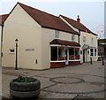
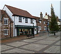
Pedestrianised section of St Mary Street, Thornbury
Looking north along an unusually deserted pedestrianised shopping area. Most shops are shut today, New Year's Day 2012.
Image: © Jaggery Taken: 1 Jan 2012
0.04 miles
  • ...