1
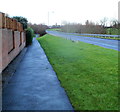
Squires Leaze, Thornbury
Viewed across Severn View Road.
Image: © Jaggery
Taken: 2 Jan 2012
0.08 miles
2
Streamside Walk Linear Park: 1
The view east from above Morton Bridge on the Gloucester Road. Thornbury's 20th-century residential estates are all to the east of the historic town. They have the feel of a New Town – planned expansion. I was reminded (favourably) of Redditch.
Image: © Robin Stott
Taken: 18 Sep 2010
0.12 miles
3
Path past Celandine Close houses, Thornbury
Viewed from Morton Way in the NE of Thornbury.
Image: © Jaggery
Taken: 2 Jan 2012
0.13 miles
4
The Anchor Inn, Morton Bridge
The Anchor Inn at Morton Bridge in Thornbury.
Image: © Philip Halling
Taken: 29 Sep 2012
0.16 miles
5
Morton Bridge, Gloucester Road
Seen from Streamside Walk Linear Park by Charles Close. That's a worrying crack in the parapet wall. The stream flows west, towards the camera.
Image: © Robin Stott
Taken: 18 Sep 2010
0.16 miles
6
Farm traffic in Thornbury
On Gloucester Road B4061 just at the edge of the square south of Morton Bridge and the Anchor Inn.
Image: © Robin Stott
Taken: 18 Sep 2010
0.16 miles
7
The Anchor Inn, Thornbury
On the corner of Gloucester Road and Park Road in the Morton area of Thornbury.
Image: © Jaggery
Taken: 2 Jan 2012
0.16 miles
8
The Anchor Inn, Thornbury
Viewed across Gloucester Road from the corner of Severn View Road.
Image: © Jaggery
Taken: 2 Jan 2012
0.17 miles
9
Path junction near Morton Way, Thornbury
Viewed from the edge of this http://www.geograph.org.uk/photo/3394950 underpass in the NE of Thornbury.
The red box on a post is for the disposal of dog excrement.
Image: © Jaggery
Taken: 2 Jan 2012
0.18 miles
10
Morton Way footpath, Thornbury
The location is at the NE edge of Thornbury.
Image: © Jaggery
Taken: 2 Jan 2012
0.18 miles


