IMAGES TAKEN NEAR TO
Gwilliam Street, BRISTOL, BS3 4LT
Introduction
This page details the photographs taken nearby to Gwilliam Street, BS3 4LT by members of the Geograph project.
The Geograph project started in 2005 with the aim of publishing, organising and preserving representative images for every square kilometre of Great Britain, Ireland and the Isle of Man.

There are currently over 7.5m images from over14,400 individuals and you can help contribute to the project by visiting https://www.geograph.org.uk
Image Map
Images are licensed for reuse under creativecommons.org/licenses/by-sa/2.0
Notes
- Clicking on the map will re-center to the selected point.
- The higher the marker number, the further away the image location is from the centre of the postcode.
Image Listing (616 Images Found)
Images are licensed for reuse under creativecommons.org/licenses/by-sa/2.0
Image
Details
Distance
1
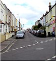
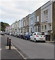
East along Gwilliam Street, Bedminster, Bristol
Viewed across Windmill Hill. Windmill Hill Convenience Store https://www.geograph.org.uk/photo/5896228 is on the right.
Image: © Jaggery
Taken: 5 Sep 2018
0.02 miles
2
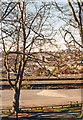
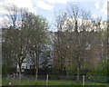
Northward from Victoria Park, Bristol 1989
In the foreground is the main railway near Bedminster station, beyond on the hill is Clifton.
Image: © Ben Brooksbank
Taken: 2 Apr 1989
0.03 miles
3
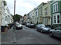
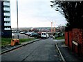
Fraser Street
Near Bedminster railway Station.
Image: © Thomas Nugent
Taken: 16 Aug 2011
0.03 miles
4
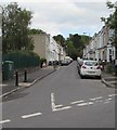
Fraser Street, Bedminster, Bristol
Viewed from Windmill Hill near Bedminster railway station.
Image: © Jaggery
Taken: 5 Sep 2018
0.03 miles
5
Fraser Street cars and houses, Bedminster, Bristol
Viewed from Windmill Hill near Bedminster railway station.
Image: © Jaggery
Taken: 5 Sep 2018
0.03 miles
7
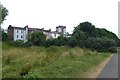
Rear of houses on Fraser Street
Looking towards houses from Victoria Park.
Image: © DS Pugh
Taken: 27 Jun 2017
0.04 miles
9
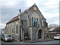
The old Methodist chapel on Algiers Street
Founded around the turn of the 1900s, it is now converted into a residential property. A small clubhouse next door, which used to hold Boys' Brigade meetings amongst other uses, has been replaced by garages.
Image: © Neil Owen
Taken: 22 Feb 2022
0.04 miles
10
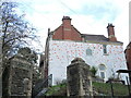
Steps to the old vicarage
St Michael and All Angels church is just a bit further up the hill, but the vicarage is now adorned with a large mural. It was built after the church around the early twentieth century and used to have a servants' annex on this wall, which was later demolished.
Image: © Neil Owen
Taken: 22 Feb 2022
0.04 miles