IMAGES TAKEN NEAR TO
Lavender Way, BRISTOL, BS32 0LR

Introduction

This page details the photographs taken nearby to Lavender Way, BS32 0LR by members of the Geograph project.

The Geograph project started in 2005 with the aim of publishing, organising and preserving representative images for every square kilometre of Great Britain, Ireland and the Isle of Man.

There are currently over 7.5m images from over14,400 individuals and you can help contribute to the project by visiting https://www.geograph.org.uk

Image Map


Images are licensed for reuse under creativecommons.org/licenses/by-sa/2.0
Notes
  • Clicking on the map will re-center to the selected point.
  • The higher the marker number, the further away the image location is from the centre of the postcode.

Image Listing (9 Images Found)

Images are licensed for reuse under creativecommons.org/licenses/by-sa/2.0
Image
Details
Distance
1
Three Brooks Nature Reserve Bradley Stoke
One of the foot path walks in the reserve.
Image: © Michael Murray Taken: 19 Sep 2009
0.12 miles
2
Webb's Wood Road
Webb's Wood Road near to St Mary's Primary School.
Image: © Ruth Riddle Taken: 22 Jun 2012
0.16 miles
3
Webb's Wood roundabout
Image: © Sarah Charlesworth Taken: 24 Jun 2010
0.17 miles
4
South Gloucestershire : M4 Motorway
The M4 Motorway between Junction 20 (Almondsbury) and Junction 19 (Hambrook Interchange).
Image: © Lewis Clarke Taken: 23 Mar 2018
0.17 miles
5
M4 to Vanishing Point
The M4 on a lazy Sunday afternoon. The photographer's position is close by in the square to the south. The Bridge in the distance is 2km away in square Image The houses to the left are in the town of Bradley Stoke (a new town nicknamed Sadley Broke during the housing market slump in the 90s). To the right is farmland.
Image: © Graham Richards Taken: 4 Feb 2007
0.17 miles
6
Bradley Stoke Nature Reserve
It's not just a new housing development; between the houses and the Motorway there is this pond and some (ok) walks.
Image: © Graham Richards Taken: 1 Jan 2006
0.18 miles
7
On the M4 heading south-east
Image: © Rob Purvis Taken: 13 Aug 2021
0.18 miles
8
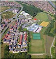
Bradley Stoke Community School
This is an aerial view of the new Bradley Stoke Community School. Towards the top of the photo is Savages Wood and in between the two is Bradley Stoke Leisure Centre. You can see Tesco's on the other side of the main road (Bradley Stoke Way).
Image: © Tony Battista Taken: 23 Aug 2005
0.24 miles
9
M4 Motorway in cutting near Bradley Stoke
Image: © J Whatley Taken: 22 Sep 2010
0.24 miles