IMAGES TAKEN NEAR TO
Ellicks Close, BRISTOL, BS32 0ES
Introduction
This page details the photographs taken nearby to Ellicks Close, BS32 0ES by members of the Geograph project.
The Geograph project started in 2005 with the aim of publishing, organising and preserving representative images for every square kilometre of Great Britain, Ireland and the Isle of Man.

There are currently over 7.5m images from over14,400 individuals and you can help contribute to the project by visiting https://www.geograph.org.uk
Image Map
Images are licensed for reuse under creativecommons.org/licenses/by-sa/2.0
Notes
- Clicking on the map will re-center to the selected point.
- The higher the marker number, the further away the image location is from the centre of the postcode.
Image Listing (17 Images Found)
Images are licensed for reuse under creativecommons.org/licenses/by-sa/2.0
Image
Details
Distance
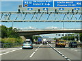
2
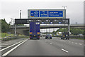
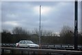
M4 near Bradley Stoke
Westbound near Junction 20
Image: © MrC
Taken: 20 Aug 2010
0.13 miles
3
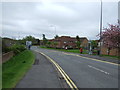
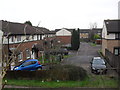
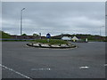
Ormonds Close
These houses are on the northern limits of Patchway and Bristol and some of the houses back onto the M4 motorway which acts as the northern limit of development.
Image: © Nigel Mykura
Taken: 17 Mar 2013
0.14 miles
4
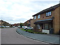
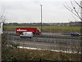
Ormonds Close
1990s houses in Patchway.
Image: © Burgess Von Thunen
Taken: 11 Feb 2013
0.14 miles
10
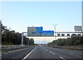
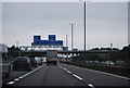
M4 Motorway Eastbound Half a Mile to Junction 19
Image: © Roy Hughes
Taken: 27 Jun 2015
0.20 miles