IMAGES TAKEN NEAR TO
New Charlotte Street, BRISTOL, BS3 1AB
Introduction
This page details the photographs taken nearby to New Charlotte Street, BS3 1AB by members of the Geograph project.
The Geograph project started in 2005 with the aim of publishing, organising and preserving representative images for every square kilometre of Great Britain, Ireland and the Isle of Man.

There are currently over 7.5m images from over14,400 individuals and you can help contribute to the project by visiting https://www.geograph.org.uk
Image Map
Images are licensed for reuse under creativecommons.org/licenses/by-sa/2.0
Notes
- Clicking on the map will re-center to the selected point.
- The higher the marker number, the further away the image location is from the centre of the postcode.
Image Listing (782 Images Found)
Images are licensed for reuse under creativecommons.org/licenses/by-sa/2.0
Image
Details
Distance
1
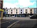
Nelson Parade from Boot Lane
Nelson Parade was built during the 1850s, and extended in the 1860s. From Northeast to Southwest, the businesses on Nelson Parade are SunRa Kitchen, Olive & Fig, The Rope Walk, Neagle & Company Limited, The Firework Shop, Burnell Tovey Ltd., and Minuteman Press.
Image: © s
Taken: 1 Apr 2023
0.03 miles
2
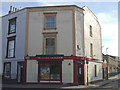
The Little Grosvenor
A traditional and fairly old local boozer in an area that was not exactly short of them in the nineteenth century.
Image: © Neil Owen
Taken: 14 Sep 2019
0.03 miles
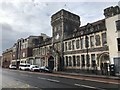
3
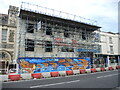
Making ready for another chapter of commerce?
The building next to the old Police station used to be a car audio shop some years ago. Following their departure, the building has fallen into disuse and is being given some much-needed work. Naturally, spray art abhors a blank panel.
Image: © Neil Owen
Taken: 23 Jul 2021
0.03 miles
5
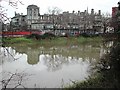
Bristol General Hospital from across the Avon
Image: © FollowMeChaps
Taken: 4 Jan 2006
0.03 miles
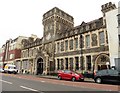
6
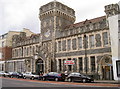
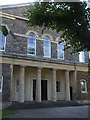
The old Police Station
This old bastion of authority (in an area that needed it) dates from around the turn of the nineteenth century. After many years of use, it was closed and the staff moved and reorganised. Currently it is a restaurant, and hopefully serves up better meals than were on offer previously.
Image: © Neil Owen
Taken: 9 Nov 2011
0.04 miles
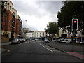
7
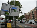
Bristol : Bedminster Parade & Road Sign
M5 South is one way, M5 North another. Bedminster Bridge Roundabout as mentioned in the sign goes over the river.
Image: © Lewis Clarke
Taken: 7 Oct 2009
0.04 miles
8
The old Zion Chapel
The Zion Congregational Chapel was built in 1829, with seats for 500 worshippers and a small graveyard. A Sunday school was added next door soon after and served the populace until closure in 1984. It is now the premises of a commercial organisation involved with furniture manufacture.
Image: © Neil Owen
Taken: 14 Sep 2019
0.04 miles