
IMAGES TAKEN NEAR TO
Kenilworth Drive, BRISTOL, BS30 6UP
Introduction
This page details the photographs taken nearby to Kenilworth Drive, BS30 6UP by members of the Geograph project.
The Geograph project started in 2005 with the aim of publishing, organising and preserving representative images for every square kilometre of Great Britain, Ireland and the Isle of Man.

There are currently over 7.5m images from over14,400 individuals and you can help contribute to the project by visiting https://www.geograph.org.uk
Image Map
Images are licensed for reuse under creativecommons.org/licenses/by-sa/2.0
Notes
- Clicking on the map will re-center to the selected point.
- The higher the marker number, the further away the image location is from the centre of the postcode.
Image Listing (79 Images Found)
Images are licensed for reuse under creativecommons.org/licenses/by-sa/2.0
Image
Details
Distance
1
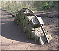
Dramway remains
This is found in the Avon Wildlife’s nature reserve and is the remains of the coal dramway which ended up at the river Avon near Keynsham.
Image: © Rick Crowley
Taken: 11 Mar 2010
0.01 miles
2
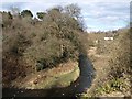
Siston Brook
Seen from the Community Forest Path as it follows the Dramway up the wooded valley. Looking upstream. Is that a pigeon?
Image: © Derek Harper
Taken: 9 Mar 2010
0.05 miles
3
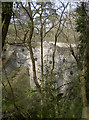
A long drop from the bridge
The Siston Brook is a fairly small river, although it has had its floods in the past. But to span the steep valley here a rather substantial bridge was built. It does not carry heavy vehicular traffic, note.
Image: © Neil Owen
Taken: 27 Mar 2017
0.06 miles
4
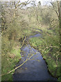
Siston Brook from the bridge
A peaceful and vibrant area upstream of the mill.
Image: © Neil Owen
Taken: 27 Mar 2017
0.06 miles
5
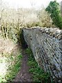
Eastern side of a waggonway bridge, Willsbridge
A branch waggonway dropped down the hill to cross Siston Brook and join the Dramway. Coal must have been expensive in the 1830s to warrant this kind of investment.
Image: © Christine Johnstone
Taken: 27 Mar 2016
0.06 miles
6
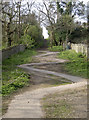
Zig-zaggery
The bridge high over the Siston Brook features a rather changeable path.
Image: © Neil Owen
Taken: 27 Mar 2017
0.06 miles
7
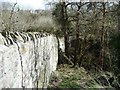
Western side of a waggonway bridge, Willsbridge
A branch waggonway dropped down the hill to cross Siston Brook and join the Dramway. Coal must have been expensive in the 1830s to warrant this kind of investment.
Image: © Christine Johnstone
Taken: 27 Mar 2016
0.07 miles
8
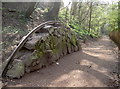
Rail over the Dramway
Another hump in the old Dramway, with a rail bent over it as a reminder of the coal drams that were run along this route.
Image: © Neil Owen
Taken: 27 Mar 2017
0.07 miles
9
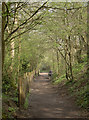
Running parallel
The old Dramway used to carry coal from the mines some miles north of here. The tracks were first laid down in 1829 onwards and were horse-drawn. However, the age of steam was just about to burst onto the scene; close by, and running largely parallel, came the Midland Railway line in 1869.
Image: © Neil Owen
Taken: 27 Mar 2017
0.07 miles
10
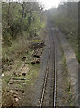
South from Cherry Garden Lane
The old (former Midland branch) line is now home to the Avon Valley Railway.
Image: © Neil Owen
Taken: 27 Mar 2017
0.08 miles