IMAGES TAKEN NEAR TO
Whalefield Road, BS29 6EB
Introduction
This page details the photographs taken nearby to Whalefield Road, BS29 6EB by members of the Geograph project.
The Geograph project started in 2005 with the aim of publishing, organising and preserving representative images for every square kilometre of Great Britain, Ireland and the Isle of Man.

There are currently over 7.5m images from over14,400 individuals and you can help contribute to the project by visiting https://www.geograph.org.uk
Image Map (Loading...)


Getting Data...Please wait
Leaflet Map data © OpenStreetMap
Images are licensed for reuse under creativecommons.org/licenses/by-sa/2.0
Notes
- Clicking on the map will re-center to the selected point.
- The higher the marker number, the further away the image location is from the centre of the postcode.
Image Listing (10 Images Found)
Images are licensed for reuse under creativecommons.org/licenses/by-sa/2.0
Image
Details
Distance
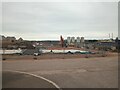
3
Locking Castle Golf Course
Image: © Adrian and Janet Quantock
Taken: 25 Nov 2005
0.14 miles
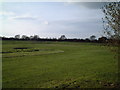
6
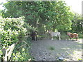
A welcome shady corner in this pony paddock in Summer Lane
Image: © Dr Duncan Pepper
Taken: 20 May 2011
0.22 miles
7
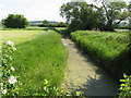
Grumble Pill Rhyne -What a Lovely Name for a Ditch!
Looks to the unwary like a concrete path, but it is covered in a dense mat of waterweed.
Image: © Dr Duncan Pepper
Taken: 20 May 2011
0.23 miles
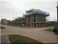
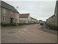
9
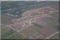
St Georges : Mead Fields
A construction site for Taylor Wimpey.
Image: © Lewis Clarke
Taken: 19 Jun 2022
0.23 miles
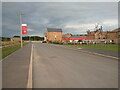
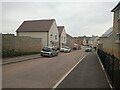
10
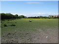
Equestrian grazing paddock beside Churchland Way
A major new build suburb of Weston-super-Mare looms in the distance.
Image: © Dr Duncan Pepper
Taken: 20 May 2011
0.25 miles