IMAGES TAKEN NEAR TO
Cooks Lane, BANWELL, BS29 6DS
Introduction
This page details the photographs taken nearby to Cooks Lane, BS29 6DS by members of the Geograph project.
The Geograph project started in 2005 with the aim of publishing, organising and preserving representative images for every square kilometre of Great Britain, Ireland and the Isle of Man.

There are currently over 7.5m images from over14,400 individuals and you can help contribute to the project by visiting https://www.geograph.org.uk
Image Map
Images are licensed for reuse under creativecommons.org/licenses/by-sa/2.0
Notes
- Clicking on the map will re-center to the selected point.
- The higher the marker number, the further away the image location is from the centre of the postcode.
Image Listing (3 Images Found)
Images are licensed for reuse under creativecommons.org/licenses/by-sa/2.0
Image
Details
Distance
1
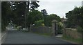
Wolvershill Road
On the northern outskirts of Banwell.
Image: © Ruth Riddle
Taken: 17 Jul 2012
0.09 miles
2
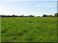
A fertile meadow adjacent to Wolvers Hill Road in Banwell
Image: © Dr Duncan Pepper
Taken: 20 May 2011
0.18 miles
3
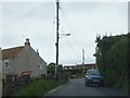
Wolvershill Road near Stonebridge Farm
Looking north-west.
Image: © Ruth Riddle
Taken: 17 Jul 2012
0.22 miles