IMAGES TAKEN NEAR TO
Banwell Road, AXBRIDGE, BS26 2XW
Introduction
This page details the photographs taken nearby to Banwell Road, BS26 2XW by members of the Geograph project.
The Geograph project started in 2005 with the aim of publishing, organising and preserving representative images for every square kilometre of Great Britain, Ireland and the Isle of Man.

There are currently over 7.5m images from over14,400 individuals and you can help contribute to the project by visiting https://www.geograph.org.uk
Image Map (Loading...)


Getting Data...Please wait
Leaflet Map data © OpenStreetMap
Images are licensed for reuse under creativecommons.org/licenses/by-sa/2.0
Notes
- Clicking on the map will re-center to the selected point.
- The higher the marker number, the further away the image location is from the centre of the postcode.
Image Listing (35 Images Found)
Images are licensed for reuse under creativecommons.org/licenses/by-sa/2.0
Image
Details
Distance
1
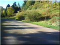
Some Autumn colours
This was just a couple of weeks before we had some very high winds which removed 90% of the leaves.
Image: © Ant Basterfield
Taken: 14 Nov 2021
0.08 miles
2
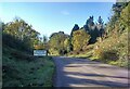
Road sign near Christon
On seeing this sign on my cycle rides, I still can't decide if it's a genuine mistake by the sign manufacturers. But it does make one pause for thought that it should perhaps read differently?
Image: © Ant Basterfield
Taken: 14 Nov 2021
0.08 miles
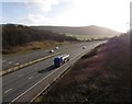
3
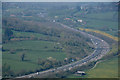
Sedgemoor : Crook Peak Scenery
Looking down towards the M5 Motorway from Crook Peak.
Image: © Lewis Clarke
Taken: 9 Apr 2017
0.14 miles
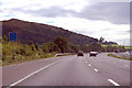
5
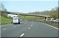
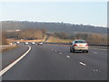
M5 near Christon (1)
Northbound between junctions 22 and 21
Image: © MrC
Taken: 24 Feb 2011
0.15 miles
7
M5 near Christon, looking towards Taunton and the South West
Image: © Ruth Sharville
Taken: 8 Apr 2010
0.16 miles
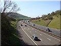
8
North Somerset : M5 Motorway
The M5 Motorway between Junction 22 (Edithmead Interchange) and Junction 21 (St Georges Interchange).
Image: © Lewis Clarke
Taken: 30 Sep 2018
0.17 miles
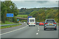
9
M5 southbound near Christon
Crook Peak on the left ahead.
At Marker 170.
Image: © J.Hannan-Briggs
Taken: 22 Sep 2015
0.18 miles