IMAGES TAKEN NEAR TO
Oakridge Lane, WINSCOMBE, BS25 1LU
Introduction
This page details the photographs taken nearby to Oakridge Lane, BS25 1LU by members of the Geograph project.
The Geograph project started in 2005 with the aim of publishing, organising and preserving representative images for every square kilometre of Great Britain, Ireland and the Isle of Man.

There are currently over 7.5m images from over14,400 individuals and you can help contribute to the project by visiting https://www.geograph.org.uk
Image Map
Images are licensed for reuse under creativecommons.org/licenses/by-sa/2.0
Notes
- Clicking on the map will re-center to the selected point.
- The higher the marker number, the further away the image location is from the centre of the postcode.
Image Listing (10 Images Found)
Images are licensed for reuse under creativecommons.org/licenses/by-sa/2.0
Image
Details
Distance

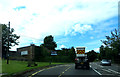
4
Field and barns by the A38
The barns straddle a grid line. This is by Grove Farm, just east of Sidcot.
Image: © Derek Harper
Taken: 20 Apr 2016
0.19 miles
5
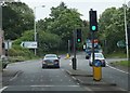
Crossroads in Sidcot
The crossroads of the A38 with Sidcot Lane to the left and Fountain Lane to the right.
Image: © Ruth Riddle
Taken: 17 Jul 2012
0.20 miles
6
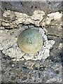
Ordnance Survey Benchmark Bolt
This bench mark was used during the Third geodetic levelling, England & Wales (1950-68). It was included on the North Petherton to Flax Bourton levelling line.
Image: © Paul Jenkins
Taken: 31 Oct 2020
0.20 miles
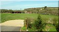
7
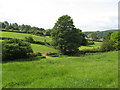
Sheep and horse grazing paddocks on the Sidcot Estate
Image: © Dr Duncan Pepper
Taken: 20 May 2011
0.20 miles
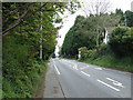
8
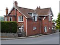
Tollhouse by the A371, Sidcot Lane, Sidcot
In the parish of Winscombe and Sandford (North Somerset District), Sidcot Gate Toll House, Sidcot Lane, the A371 at the junction with the A38, Bristol Road.
Surveyed
Milestone Society National ID: AV.WIN
Image: © Alan Rosevear
Taken: 24 Jun 2013
0.21 miles
10
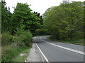
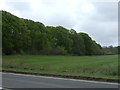
A bend in Bristol Road (A38)
Heading north east towards Bristol.
Image: © JThomas
Taken: 10 May 2013
0.25 miles