
IMAGES TAKEN NEAR TO
Rockeries Drive, WINSCOMBE, BS25 1DN
Introduction
This page details the photographs taken nearby to Rockeries Drive, BS25 1DN by members of the Geograph project.
The Geograph project started in 2005 with the aim of publishing, organising and preserving representative images for every square kilometre of Great Britain, Ireland and the Isle of Man.

There are currently over 7.5m images from over14,400 individuals and you can help contribute to the project by visiting https://www.geograph.org.uk
Image Map
Images are licensed for reuse under creativecommons.org/licenses/by-sa/2.0
Notes
- Clicking on the map will re-center to the selected point.
- The higher the marker number, the further away the image location is from the centre of the postcode.
Image Listing (54 Images Found)
Images are licensed for reuse under creativecommons.org/licenses/by-sa/2.0
Image
Details
Distance
1
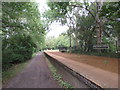
Winscombe former railway station
The Strawberry Line path passing through the former railway station at Winscombe in Somerset. The station closed in 1963, but the platform is restored.
The path forms part of National Cycle Network route 26.
Image: © Malc McDonald
Taken: 23 Aug 2020
0.02 miles
2
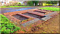
Re-creation of station facade, Winscombe
The facade re-created flat on the ground !
Image: © John Brightley
Taken: 11 Dec 2016
0.03 miles
3

Railway Platform at Former Winscombe Station
Image: © Sandy Gerrard
Taken: 3 Jun 2024
0.03 miles
4
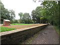
Winscombe former railway station
The Strawberry Line path passing through the former railway station at Winscombe in Somerset. The station closed in 1963, but the platform is restored.
The path forms part of National Cycle Network route 26.
Image: © Malc McDonald
Taken: 23 Aug 2020
0.03 miles
5
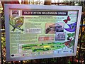
Information Board at Old Station Millennium Green
Image: © John Brightley
Taken: 11 Dec 2016
0.04 miles
6
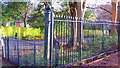
Railing detail, former Winscombe station
Image: © John Brightley
Taken: 11 Dec 2016
0.04 miles
7
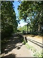
Platform, Winscombe station, on Strawberry Line
Image: © David Smith
Taken: 1 Oct 2021
0.04 miles
8
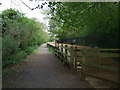
Former platform, Winscombe Station
The Strawberry Line (railway trail).
Image: © JThomas
Taken: 10 May 2013
0.05 miles
9
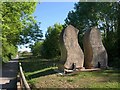
Millennium Green Sculpture, Winscombe
Another view of Image from the opposite direction. This is the work of Dick Boulton, carved in Doulting limestone, a stone carried on this railway.
"The sculpture symbolises a pair of railway lines snaking away into the distance. Some people say that the ‘SS’ stands for ‘Strawberry Special’, the name given to the regular passenger train service along the Cheddar Valley Railway, the railway which passed through Winscombe" http://www.wsmg.org.uk/
Image: © Derek Harper
Taken: 24 May 2010
0.06 miles
10
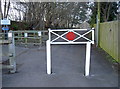
A railway shape
The traditional red circle found on older railway property remains as a nod to the past. The former 'Strawberry Line' ran through Winscombe until Dr Beeching brought about its closure in 1963. Since then, it has become a popular walking and cycling link. The station was previously known as Woodborough - the village close to Winscombe.
Image: © Neil Owen
Taken: 25 Jan 2017
0.06 miles