1
AW Leisure, Weston-super-Mare
Located on the south side of Broadway. A sign on the premises describes the business as "New and nearly new vehicle sales and leasing".
Image: © Jaggery
Taken: 27 Jul 2011
0.04 miles
2
Atlantic Broadway, Weston-super-Mare
Located on the south side of Broadway between AW Leisure http://www.geograph.org.uk/photo/2562594 and a Tesco Express store.
Originally a fish and chip shop, now also a burger bar, as shown by a sign on the building.
Image: © Jaggery
Taken: 27 Jul 2011
0.04 miles
3
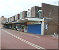
Aller Parade
Local shops on Oldmixon Estate
Image: © Adrian and Janet Quantock
Taken: 22 Oct 2005
0.04 miles
4
Mini-roundabout and bungalows, Broadway, Weston-super-Mare
Walnut Close bungalows face Broadway, a mini-roundabout, Winterstoke Road and the Walnut Tree pub. http://www.geograph.org.uk/photo/2559247 Turn left for Hutton, Locking and Banwell. Turn right for the hospital, Uphill, Bleadon and the beach. Also for Bridgwater and Taunton.
A temporary yellow sign points towards a sand sculpture festival.
Image: © Jaggery
Taken: 27 Jul 2011
0.04 miles
5
Barnabas Open Doors Centre, Oldmixon, Weston-super-Mare
Located at the western end of Aller Parade, the centre is run by St Barnabas Church, Westbury Crescent, Oldmixon.
Image: © Jaggery
Taken: 27 Jul 2011
0.09 miles
6
Oldmixon Primary School, Weston-super-Mare
Viewed across Monkton Avenue. There are about 240 pupils enrolled (ages 3 to 11).
Image: © Jaggery
Taken: 27 Jul 2011
0.09 miles
7
Oldmixon Family Centre, Weston-super-Mare
Located on Monkton Avenue, next door to Oldmixon Primary School. http://www.geograph.org.uk/photo/2562255
Image: © Jaggery
Taken: 27 Jul 2011
0.09 miles
8
Aller Parade post office, Weston-super-Mare
The post office is located in a row of shops on the west side of Winterstoke Road.
Image: © Jaggery
Taken: 27 Jul 2011
0.09 miles
9
The Walnut Tree, Weston-super-Mare
Viewed from Winterstoke Road across the pub's car park. The far side of the pub borders Broadway.
Image: © Jaggery
Taken: 27 Jul 2011
0.10 miles
10
Winterstoke Road, Weston-super-Mare
The view from near the corner of Broadway looking along Winterstoke Road towards Oldmixon Road. Hay Wood is in the background.
Image: © Jaggery
Taken: 27 Jul 2011
0.10 miles


