1
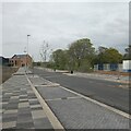
Anson Road looking West
On the right is the GP surgery, which is currently in construction.
Image: © s
Taken: 26 Apr 2023
0.02 miles
2
Former RAF Locking
The large building is the new Winterstoke Hundred Academy secondary school in construction.
RAF Locking was built in 1939, and closed on 31st March 2000 at 4pm. Work to demolish the buildings on the site started in 2003 and was completed in 2004, although not all the buildings were demolished.
Image: © s
Taken: 26 Apr 2023
0.04 miles
3
Apprentice Way looking North
Image: © s
Taken: 10 May 2021
0.04 miles
4
Former tennis court at the former RAF Locking
Looking towards the new Winterstoke Hundred Academy secondary school being built.
Image: © s
Taken: 26 Apr 2023
0.04 miles
5
Anson Road looking East
The building on the left is the GP surgery, which is currently in construction.
Image: © s
Taken: 26 Apr 2023
0.06 miles
6
Site of the Airmen's club at the former RAF Locking
RAF Locking was built in 1939, and closed on 31st March 2000 at 4pm. Work to demolish the buildings on the site started in 2003 and was completed in 2004, although not all the buildings were demolished.
Image: © s
Taken: 26 Apr 2023
0.07 miles
7
Site of S.N.C.O's Mess and Single Quarters on the former RAF Locking
RAF Locking was built in 1939, and closed on 31st March 2000 at 4pm. Work to demolish the buildings on the site started in 2003 and was completed in 2004, although not all the buildings were demolished.
Image: © s
Taken: 26 Apr 2023
0.07 miles
8
Winterstoke Hundred Academy secondary school in construction
Taken from Anson Road.
Image: © s
Taken: 26 Apr 2023
0.07 miles
9
Apprentice Way looking Southwest
Looking towards the new Winterstoke Hundred Academy secondary school, which is currently in construction.
Image: © s
Taken: 26 Apr 2023
0.07 miles
10
Winterstoke Hundred Academy secondary school in construction
Taken from the former RAF Locking tennis court car park.
Image: © s
Taken: 26 Apr 2023
0.07 miles


