IMAGES TAKEN NEAR TO
Varsity Way, WESTON-SUPER-MARE, BS24 7DH
Introduction
This page details the photographs taken nearby to Varsity Way, BS24 7DH by members of the Geograph project.
The Geograph project started in 2005 with the aim of publishing, organising and preserving representative images for every square kilometre of Great Britain, Ireland and the Isle of Man.

There are currently over 7.5m images from over14,400 individuals and you can help contribute to the project by visiting https://www.geograph.org.uk
Image Map
Images are licensed for reuse under creativecommons.org/licenses/by-sa/2.0
Notes
- Clicking on the map will re-center to the selected point.
- The higher the marker number, the further away the image location is from the centre of the postcode.
Image Listing (49 Images Found)
Images are licensed for reuse under creativecommons.org/licenses/by-sa/2.0
Image
Details
Distance
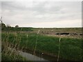
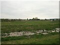
8
Field off Locking Head Drove looking towards Locking Head Farm
Image: © s
Taken: 17 Apr 2023
0.16 miles
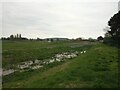
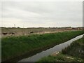
9
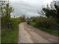
Locking Head Drove looking South
The access to Locking Head Farm.
Image: © s
Taken: 17 Apr 2023
0.18 miles
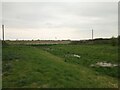
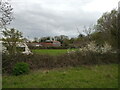
10
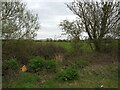
Field off Locking Head Drove
In the background is the new housing estate at Mead Fields.
Image: © s
Taken: 17 Apr 2023
0.18 miles