
IMAGES TAKEN NEAR TO
Trewartha Park, WESTON-SUPER-MARE, BS23 2RT
Introduction
This page details the photographs taken nearby to Trewartha Park, BS23 2RT by members of the Geograph project.
The Geograph project started in 2005 with the aim of publishing, organising and preserving representative images for every square kilometre of Great Britain, Ireland and the Isle of Man.

There are currently over 7.5m images from over14,400 individuals and you can help contribute to the project by visiting https://www.geograph.org.uk
Image Map
Images are licensed for reuse under creativecommons.org/licenses/by-sa/2.0
Notes
- Clicking on the map will re-center to the selected point.
- The higher the marker number, the further away the image location is from the centre of the postcode.
Image Listing (142 Images Found)
Images are licensed for reuse under creativecommons.org/licenses/by-sa/2.0
Image
Details
Distance
1
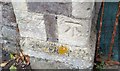
Ordnance Survey Cut Mark
This OS cut mark can be found on the gatepost of The Brow, No35 Trewartha Park. It marks a point 27.328m above mean sea level.
Image: © Adrian Dust
Taken: 30 Jul 2018
0.02 miles
2
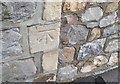
Ordnance Survey Cut Mark
This OS cut mark can be found on the gatepost of No40 Montpelier. It marks a point 29.861m above mean sea level.
Image: © Adrian Dust
Taken: 30 Jul 2018
0.03 miles
3

At the end of Montpelier Path
The path reaches Montpelier and Trewatha Park, and a postbox is set into the walling. See Image] for a closer look.
Image: © Neil Owen
Taken: 11 Sep 2025
0.04 miles
4

A Montpelier letterbox
One from the reign of George VI, made by W. T. Allen of London. See Image] for a location view.
Image: © Neil Owen
Taken: 11 Sep 2025
0.04 miles
5

Paint on Montpelier Path
A utility box is canvas, despite being electrified.
Image: © Neil Owen
Taken: 11 Sep 2025
0.05 miles
6
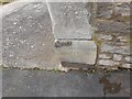
Ordnance Survey Cut Mark
This OS cut mark can be found on the gatepost of No7 Montpelier.. It marks a point 81.23ft above mean sea level.
Image: © Adrian Dust
Taken: 28 Jul 2023
0.06 miles
8
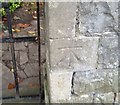
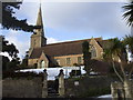
Ordnance Survey Cut Mark
This OS cut mark can be found on the gatepost of Beaufort Lodge. It marks a point 18.328m above mean sea level.
Image: © Adrian Dust
Taken: 30 Jul 2018
0.07 miles
9
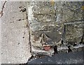
Ordnance Survey Cut Mark
This OS cut mark can be found on the gatepost of Clarence House, Montpelier. It marks a point 35.067m above mean sea level.
Image: © Adrian Dust
Taken: 30 Jul 2018
0.07 miles
10
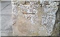
Ordnance Survey Cut Mark
This OS cut mark can be found on the gatepost of No18 Trewartha Park. It marks a point 36.262m above mean sea level.
Image: © Adrian Dust
Taken: 30 Jul 2018
0.08 miles