
IMAGES TAKEN NEAR TO
Montpelier, WESTON-SUPER-MARE, BS23 2RN
Introduction
This page details the photographs taken nearby to Montpelier, BS23 2RN by members of the Geograph project.
The Geograph project started in 2005 with the aim of publishing, organising and preserving representative images for every square kilometre of Great Britain, Ireland and the Isle of Man.

There are currently over 7.5m images from over14,400 individuals and you can help contribute to the project by visiting https://www.geograph.org.uk
Image Map
Images are licensed for reuse under creativecommons.org/licenses/by-sa/2.0
Notes
- Clicking on the map will re-center to the selected point.
- The higher the marker number, the further away the image location is from the centre of the postcode.
Image Listing (83 Images Found)
Images are licensed for reuse under creativecommons.org/licenses/by-sa/2.0
Image
Details
Distance
1
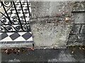
Ordnance Survey Cut Mark
This OS cut mark can be found on gatepost of No29 Montpelier. It marks a point 39.283m above mean sea level.
Image: © Adrian Dust
Taken: 28 Jul 2023
0.01 miles
2
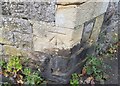
Ordnance Survey Cut Mark
This OS cut mark can be found on the NE wall angle south side of Bristol Road Lower. It marks a point 42.111m above mean sea level.
Image: © Adrian Dust
Taken: 30 Jul 2018
0.03 miles
3

John Lewis plaque on Bristol Road Lower
The famous London draper purchased this house in 1876.
Image: © DS Pugh
Taken: 28 Jun 2025
0.05 miles
4
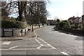
Bristol Road Lower
From its junction with Arundel Road with Eastfield Park on the left.
Image: © Bob Embleton
Taken: 5 Mar 2012
0.06 miles
5
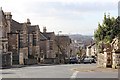
Arundel Road
Viewed from its junction with Bristol Road Lower.
In the far distance is St. Nicholas' C of E Church, Uphill.
Image: © Bob Embleton
Taken: 5 Mar 2012
0.06 miles
6

Eastfield Park
Private gardens alongside Bristol Road Lower.
Image: © Bob Embleton
Taken: 5 Mar 2012
0.06 miles
7
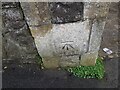
Ordnance Survey Cut Mark
This OS cut mark can be found on the gatepost of No38 Arundel Road. It marks a point 34.314m above mean sea level.
Image: © Adrian Dust
Taken: 23 Dec 2022
0.06 miles
8
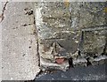
Ordnance Survey Cut Mark
This OS cut mark can be found on the gatepost of Clarence House, Montpelier. It marks a point 35.067m above mean sea level.
Image: © Adrian Dust
Taken: 30 Jul 2018
0.06 miles
9
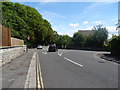
Bristol Road-Lower, Weston-super-Mare
Junction with Arundell Road.
Image: © JThomas
Taken: 12 Jul 2019
0.07 miles
10
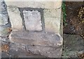
Ordnance Survey Cut Mark
This OS cut mark can be found on the gatepost east side of Arundel Road. It marks a point 42.428m above mean sea level.
Image: © Adrian Dust
Taken: 30 Jul 2018
0.08 miles